Circular tour in Pedraforca
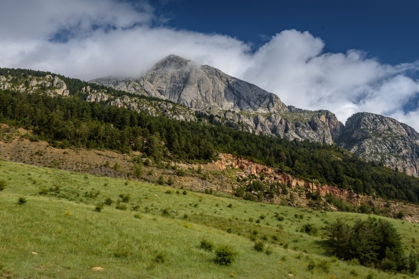
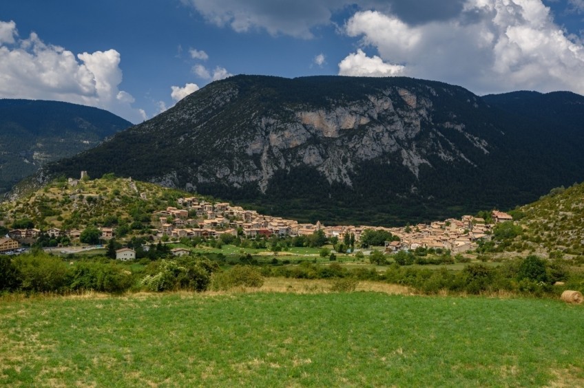
Pedraforca has many points of view. The most common is to walk to the top and contemplate the panorama from the heights. But another easy and affordable option is to turn around your feet, to have a perspective of all the angles of the mountain and to be able to say that you have completed a return to the most emblematic massif of Catalonia.
- Difficulty: easy. No notable difficulties
- Elevation gain: 780 m of accumulated ascent
- Time: between 3h45 and 4h45, depending on stops. Partial: 1h10 'from Gósol to Collell, 55' to the Estaen refuge, 55 'to Coll de Jou, 1h 05' to Gósol again.
- Kilometers: 16.6 km
Variants: El Pedraforca has many itineraries through the peaks and at mid-altitude. A possible 360º turn at a higher altitude could be considered, through the septfonds area and the Coll de Verdet on the north slope, but it would be necessary to see if the south slope can be crossed by Prat de Reu and Roc Roig. Likewise, there are sections that coincide with other itineraries such as the Camino de los Cátaros or Los Cavalls del Vent.
We start from the Plaza Mayor, the nerve center of Gósol. From there, we go through Calle Picasso (eastbound) and, in Plaza de Agustín Pedro Pons, we turn left to take Calle Cerdanya, heading north. Leaving the town, we take a path following the GR and PR marks. It is the Camino de los Cátaros (GR-107), which in this section coincides with the GR-150 (the Vuelta al Cadí) and the PR-C-127 (the Vuelta al Pedraforca), as well as the Camino de Cerdanya o Path of the Gosolans Pass, which was formerly used by the reapers to cross towards Bellver de Cerdanya. As you can see, a whole knot of roads and that is also noticeable in the marks.
We began to climb a well-groomed path through pine forests that, early in the day, still enjoy the shade and the cool morning. After about 20 minutes, we found a detour to the right of a path that would take us back to Gósol through the Coll de la Guardia. Shortly after, we arrive at the recreational area of Fuente Terreros (1625 m), from where you can also get there by car and from where the route of the Little Herrerillo starts, ideal for doing with children.
We cross the Fuente Terreros pass, we see the fountain on the left, and we continue along the path that enters the forest before us. In 5 minutes we found a detour to the right that would take us up through the Coma de Caners towards septfonds and the Coll de Verdet, which would serve to go up to Pollegó Superior. We continue there and now face the strongest uphill section of the route. We avoid a detour to the left (well signposted) during the ascent.
The forest opens up and the views of the Josa valley and the Cadí begin to expand. The path turns in a Northeast direction after crossing a small pass, the Serrat de la Portella. Now we walk gliding towards the Collell, visible at the end of the valley. We pass by the side of the Fuente de la Roca, which as its name indicates is an upwelling that springs up in the middle of the rock. We continue through this area of meadows with some pine trees until we reach Collell, the boundary between the tributary waters of the Llobregat (to the east) and those of the Segre (to the west), and we also change province although we do not change region part of the province of Lleida).
Now we leave the marks of gr.-107 and 150 and we to face the gentle descent down the track to the Lluís Estaen refuge. This section coincides with the Cavalls del Vent route. For about an hour, we plan the gentle descent down the track. Perhaps this section is more monotonous to be all track. But we can be distracted by the exceptional environment that surrounds us: on the one hand, the southern slope of the Cadí and the spectacular cliffs of the Gresolet valley. On the other, the abundant mountain, one of the best preserved in Berguedà, with impressive pine, fir, beech and other species such as hazelnuts. And finally, for the view towards the north face of Pedraforca, always imposing.
In half an hour from the Collell, we will reach the Coll de Pi Ajagut. In this section, we pass by several channels that descend from Pedraforca: the Raspberry Channel, the Coll de Verdet or the Riambau Channel, which only carry water after a period of rain. In your case when you go, after a strong storm is when you see real waterfalls. Nothing to envy to other places in the calcareous Pyrenees such as Ordesa or Pineta.
15 minutes later, we will arrive at the turnoff to the Lluís Estaen refuge. We must be attentive to the red marks that come out to the right, going up a path above. Otherwise, later on, we will see some parked cars and another way up to the Lluís Estaen Refuge. We arrived in 5 minutes.
No matter how many times it has been, the picture of the refuge with the north face of Pedraforca is splendid and well worth a stop to contemplate this idyllic corner of Berguedà.
Now they continue in the direction of the path that comes from the Pedraforca lunch box, heading south. After 200 meters we see the deviation to the right of the path that goes to the Saldes tartera, but we follow the indications of PR-C 127, towards Gósol, along the path to the left.
For about 15 minutes we continued to glide down the eastern slope of Pedraforca until we found another signpost. We follow the indication of Gósol and the PR marks again and we begin a section of steep descent. We lose 100 meters of height in a short time. The transition of the forests of the north slope, more humid, with those of the south slope, more sunny becomes evident from this area. Here the forest is red pine and the terrain is no longer so humid. The path opens up and becomes a track and, immediately afterwards, we come to a vast meadow.
In reality we are in the old opencast mines of Saldes. The later restoration that was made of this space still shows signs of a land removed by man, with trees smaller than those of the surrounding forest and large areas of meadows.
We cross this entire section of the old mines on a track, gliding up to Coll de Jou. The views from here allow us to glimpse the vertical wall of Pollegó Inferior, but also the Ensija and Verde mountains on the other side.
From Coll de Jou, we leave the track and take a path to the right that goes down to near a pond that originated with the mines. The path enters the forest again and we begin our return to Gósol. The path loses a bit of height until it reaches Can Bardines. At this point, it is convenient to look at the PR marks that go down to the road, since otherwise we will deviate along a track and we would make a little return. This section down to the road is not very beaten.
We cross the B-400 and continue on the side of the road for about 200 meters, on the left side. Next, the path goes down a bit and we continue parallel to the road but a little further apart. On this section to the Coll del Cap de la Creu (10 min) we cross several pasture spinning fences up to 4 times.
We reach the neck and, next to it, we see the Cap de la Creu viewpoint, from where the entire valley of Gósol and Sorribes can be seen perfectly. From here, we only need 1 kilometer to reach Gósol following the track that runs parallel to the road. When we have reached the town of Gósol, we will have completed a great 360 degree circular loop in Pedraforca.
Image and text authorship: Sergi Boixader
What to do
Estació d'Esquí Tuixent - La Vansa
Josa i Tuixent (a 11.4 Km)Enjoy 30km of multi-level circuits for cross-country skiing and snowshoeing at the…
Penyes Altes Outdoor Services
Bellver de Cerdanya (a 13.7 Km)Discover new places and new adventures with the help of our team…
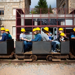
Museu de les Mines de Cercs
Cercs (a 10.8 Km)Dedicated monographically to coal, it is a museum of technique and history…
Where to eat
Restaurant Apartaments Els Roures
Castellar del Riu (a 13.9 Km)Rest, charm and good cuisine, a unique space located in Berguedà, at…
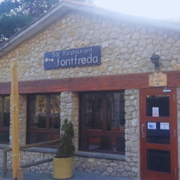
Restaurant Font Freda
Castellar del Riu (a 14.2 Km)A restaurant offering a wide selection of Catalan dishes, especially notable for…
El Recó de l'Avi
Guardiola de Berguedà (a 11.5 Km)Typical homemade cuisine, with oak-grilled meats, a wide variety of tapas and…
Bar Restaurant El Jardí
Sant Llorenç de Morunys (a 12.7 Km)The Bar-Restaurant El Jardí de Sant Llorenç de Morunys offers traditional cuisine…
Where to sleep
Restaurant Apartaments Els Roures
Castellar del Riu (a 13.9 Km)Rest, charm and good cuisine, a unique space located in Berguedà, at…
Hotel Casa Duaner
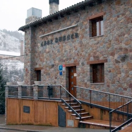
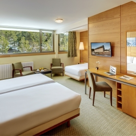
Guardiola de Berguedà (a 11.5 Km)The Casa Duaner Hotel in Guardiola de Berguedà offers modern facilities, a…
Hotel & Spa La Collada
Toses (a 11.7 Km)Hotel & Spa La Collada, a 4-star hotel with 90 rooms located…

