Pollegó Superior del Pedraforca through Verdet's neck

If among all the emblematic peaks of Catalonia we had to choose one, due to the variety of corners and a most entertaining route, this is undoubtedly Pedraforca. The Pollegó Superior is one of the busiest peaks in the Catalan Countries and many weekends in the summer there are authentic pilgrimages to the climb, up to the top and even in the lunch box. But despite this overcrowding, it is always a pleasure to go up, return and crown it, it is the Piedra.
- Difficulty: medium. Special attention to the wear of the mountain. Be very careful in case of rain or snow (inadvisable).
- Elevation: 956 meters ascent
- Time: between 5h and 6h, with stops. 3h ascent to Pollegó Superior (1h30 'current)
- Kilometers: 8 km
Variants: El Pedraforca has many itineraries. The Pollegó Superior is mainly conquered from the corner of Saldes (following this route), or by Gósol, by the Gósol lunch box. Likewise, you can go up to Pollegó Inferior by the Gran Diagonal and discover a totally different Pedraforca. And those who prefer to go more on a flatter route, there is the PR-C127 called "Pedraforca 360º" that goes around the massif.
As we have said, Pedraforca is one of the busiest peaks in Catalonia. More than 20,000 people each year go down the lunch box. All this has caused wear that is accentuated over the years and that entails a special precaution. In all sections of rock we will find the stone sharp force and this can be a reason for slipping. Especially delicate is the descent through the lunch box, which is becoming more and more worn every day.
Likewise, it must be borne in mind that Pedraforca, without being difficult, is not a "top of cows" either. The climb up Verdet is not difficult, but it is good that he has done some previous climb to learn the technique and see how he reacts to heights. The descent through the lunch box is very fun for some, but for those who have never downloaded any, it can be heavy. Once in the ass and some scratching is almost inevitable, but you have to be careful not to hurt yourself. Many people go to Pedraforca without having done any other mountain before and, in some cases, without knowing the mountain or the weather. Every year many people must be rescued and some reckless acts are committed. Find out about the weather and, if in doubt, go up some other peak before doing the Pedraforca.
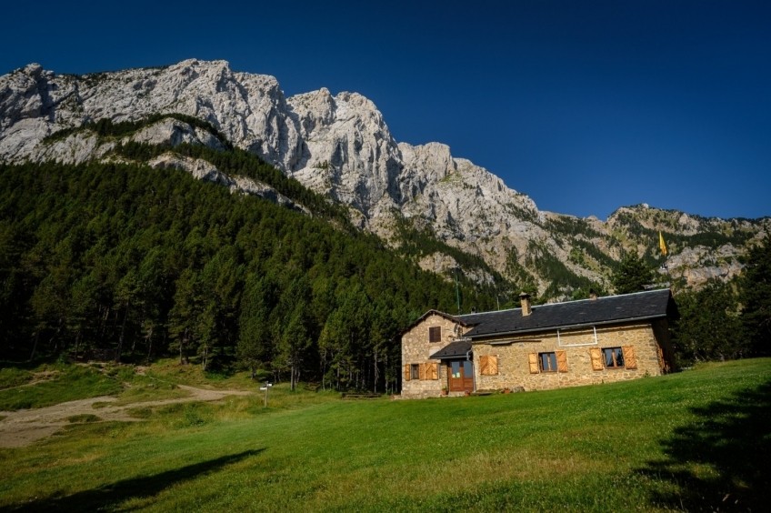
We leave the parking lot of the Mirador de Gresolet and take the stepped path that comes out next to the road and that indicates the Lluís Estaen refuge. This first section runs through a black pine forest with a moderate slope and a very sharp path. It has the roots that are on the road as a result of erosion. After a while, you will see that there is a fork in the road: both the left and the right lead to the same place, but the left is faster. 10 minutes later, they converge on a small hill where we find an indicator to go to the refuge. Here you have to take the path to the left, since the one to the right deviates down the northern slope. All the time we will be following the PR marks.
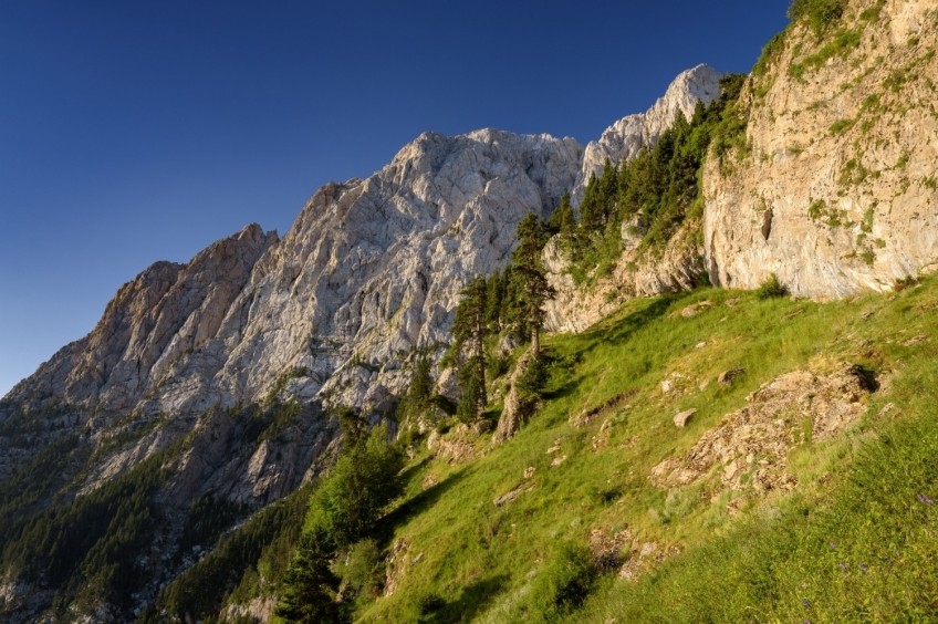
We arrive at the refuge 15 minutes after the start and we already see the objective clearly: the Pollegó Superior crowning the steep north face of Pedraforca. We continue forward, towards Verdet's neck. Now we glide through the shady forest of Pedraforca and we will cross four ravines without great difficulty, only the slips count, especially if it is wet or there is ice. At the first ravine, if we look up, we will see the unmistakable silhouette of "El Gato", one of the most special climbs in Pedraforca.
Once the Rimbau canal has been passed, the path begins to climb decisively. We go up through a forest with a considerable slope, following the PR marks. Be careful when the road changes direction, to meander. If you follow the PR marks and the sharpest path, there is no loss. Halfway up, we will see a trunk lying and empty inside, which a few years ago was a very photographed place.
The path goes up to the Rua Grande cave, where it turns west. Before arriving, we will see how the PR takes a first easy climb (be careful not to deviate to the right). The section under the grotto offers spectacular views of the Cadí. Next, we come to a small valley with a stream where we can catch water. The path now turns left and returns to the forest. On foggy days in the valleys, from here we will have a fantastic panoramic view over a sea of clouds.
We climb higher and higher and now we can see Verdet's neck, although quite high up. We face the right uphill section winding past some hundred-year-old black pine trees. Opposite, the north face of Pedraforca, closer and closer. Many people, at this point, start to eat breakfast. If you have the strength, it is worth waiting up to Verdet's neck.
The last section of access to the neck can be done by two paths, both marked with the PR marks. The one on the right goes up first and saves going through the lunch box, so it is a better option for the climb (the GPS track goes the way on the left).
Finally, we reached Verdet's neck after sweating for a long time. From here you can already see the town of Gósol and the Sierra del Verde and Port del Comte. Now the path continues up the ridge until it reaches the Verdet channel.
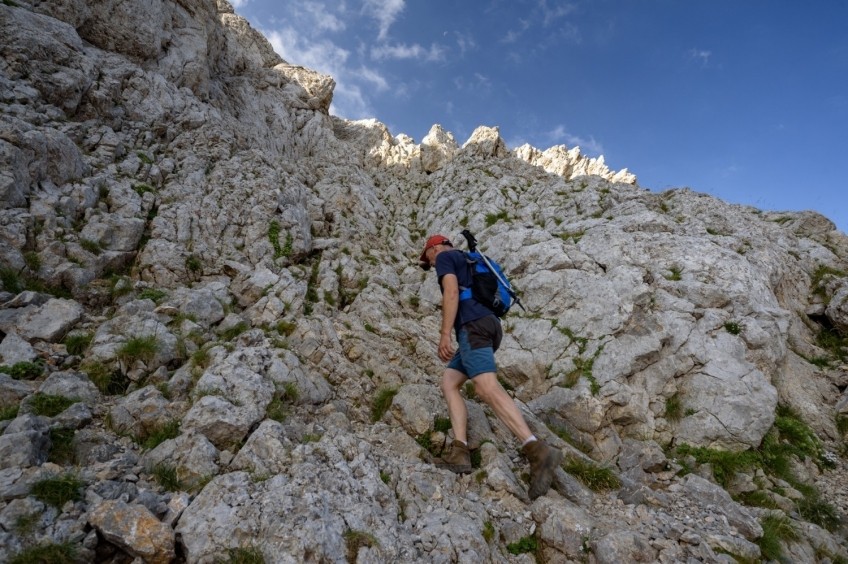
From here the real climb begins. The first section of the canal is more open and easier. We see that it is marked with yellow traces, but if we want, we can climb further to the left. As we go up, it fits in and is a little straighter. In this second section of the canal, the stone is sharper since everyone has to go through the same place. You have to be more careful and, if you need it, there is a rope to hold onto.
Finally, we reach the north summit (1st above) and discover what awaits us until we reach Pollegó Superior. The hull makes 4 avantcims before reaching the highest peak. So we will have to go doing a seesaw with small descents and climbs. We descend from the first antecima without difficulty up to the neck. The yellow marks will guide us through the easiest places to pass. To face the second antecima, the marks first glide to the right to find a wide channel with a moderate slope.
We crown the 2nd antecima, and we descend with a fairly steep section to the next hill. The 3rd antecima does not present any great difficulty and we climb to the top in a short time. We continue, now downhill to the last hill, quite narrow and clayey in color. If we look to the left, we will see the entire patio on the north face of Pedraforca.
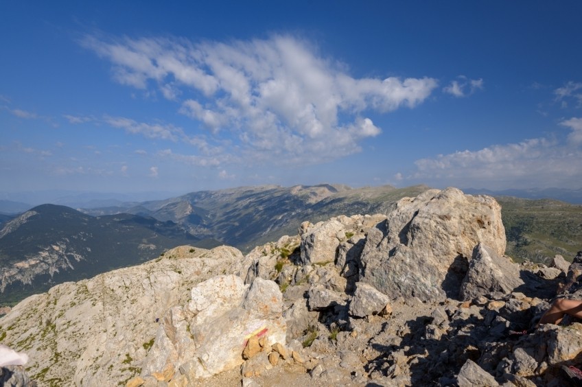
We finally face the climb to Pollegó Superior. This fourth climb is a little more straight and it is convenient to keep the yellow markings in sight so as not to complicate our lives. We go up looking for the easiest steps and finally we go up the last meters to the top of Pollegó Superior, where we will surely find a lot of people.
To go down, we are going to look for the enforcadura by the obvious path that goes down on the other side of where we have climbed. The descent is easy, but with some stretches a bit worn. In a short time, we reached the enforcadura. On the other side, we see the vertical wall of Pollegó Inferior, which can only be climbed on foot on the south / east side.
We got off the enforcadura and faced the lunch box. Most people pass on the left, but the descent is very worn and can even be compromised. On the right wing, traditionally the ground was less worn, but with the creation of a new PR road, things are being leveled right now. If you don't want to risk skating down the lunch box, you can go down the PR. The first section of the lunch box is the most straight and worn; further down you will see how the rocks that have been brought down from higher up accumulate.
Later, the pan is divided in two and in the center box trees and some black pine begin to grow. We continue along the most obvious one, the one on the left, until we reach a point where the path that leaves the lunch box begins. It is important not to continue to the right, locker down, since then we would turn further.
We follow the path with PR marks and a gentle descent that will take us in about 20-25 minutes to the refuge, crossing some fields. We avoid a deviation that goes to the right, down, and we continue along the path of the PR. Finally, we arrive at the refuge and we will only have to make a drink of water from the source and face the return to the Gresolet viewpoint, by the same path where we have climbed in the morning.
Authorship of photographs and text: Sergi Boixader
What to do
Penyes Altes Outdoor Services
Bellver de Cerdanya (a 13.7 Km)Discover new places and new adventures with the help of our team…
Museu de les Trementinaires
Josa i Tuixent (a 7.7 Km)The Tuixent Trementinaires Museum opened its doors in 1998 to preserve the…
Where to eat
El Recó de l'Avi
Guardiola de Berguedà (a 11.5 Km)Typical homemade cuisine, with oak-grilled meats, a wide variety of tapas and…
Restaurant Apartaments Els Roures
Castellar del Riu (a 13.9 Km)Rest, charm and good cuisine, a unique space located in Berguedà, at…
Bar Restaurant El Jardí
Sant Llorenç de Morunys (a 12.7 Km)The Bar-Restaurant El Jardí de Sant Llorenç de Morunys offers traditional cuisine…
Restaurant Font Freda
Castellar del Riu (a 14.2 Km)A restaurant offering a wide selection of Catalan dishes, especially notable for…
Where to sleep
Hotel & Spa La Collada
Toses (a 11.7 Km)Hotel & Spa La Collada, a 4-star hotel with 90 rooms located…
Restaurant Apartaments Els Roures
Castellar del Riu (a 13.9 Km)Rest, charm and good cuisine, a unique space located in Berguedà, at…
Hotel Casa Duaner
Guardiola de Berguedà (a 11.5 Km)The Casa Duaner Hotel in Guardiola de Berguedà offers modern facilities, a…


