Looking for mushrooms in Berguedà and Solsonès
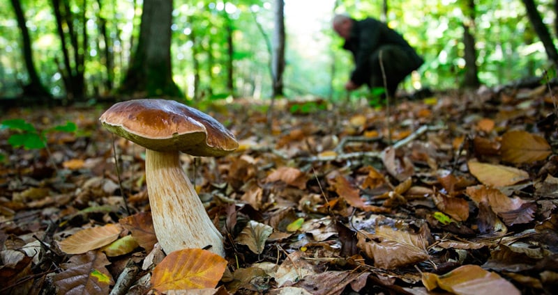
Mushroom hunting has become a national sport in its own way and we have to enjoy our forests. Go to look for mushrooms and is a general obsession, and this is great news because it means that citizens of this country appreciates and loves the natural environment and wants to enjoy it. But overcrowding is also a threat that can endanger our forests, especially if you ride without respect. So you have to promote knowledge of the territory and respect for nature.
In the following lines, you will find a selection of sixteen routes where surely find mushrooms. Since they are highly productive areas, at the discretion of one of the leading experts in this country, Marc Estévez Casabosch.
So, we divide the territory into different regions and each of them in different areas.
Route's villages
The Voltrera baga (Alt Berguedà)
 From the Coll de la Bena continue to walk the shady, following the layout of the road bounded GR-107. We are in a remarkable red pine forest that was cleared and cleared up not too long ago, a forestry action that will surely increase the mycological production in coming seasons. Chanterelles and pinetells are abundant, as well as boldface (fredolics), the cockscomb and white mushrooms (blanques llenegues). Notably, some more mature pine forest clearings that lie in the areas of forest located at higher altitudes because some seasons offer us always finding ceps magnífio both species Boletus edulis Boletus as pinophilus.
How to get
Log in Bagà from the Axis of Llobregat, the C-16. Take the Reina Elisenda avenue and you 'll end up on the BV-4024 road, which leads to Coll de Pal Gisclareny and approximately 8 km, reach the Voltrera baga GPS coordinates:.. 42.260342, 1.766029
Pera plans (Alt Berguedà)
 From the road between Castellar de n'Hug with Montgrony, the proposed area is easily accessible on foot from the hole stretch between Arija and rocks Espluga. We climbed about ten minutes through the forest of Moles, and we are located Plans in Pera, a large area dominated by red pine, along with some light oak in dark corners, which plans towards Montgrony, almost all the time at altitudes of about 1,400 m. altitude. The area early if the summer has been cool and rainy, offers níscalo, Pinetell, camagroc, rossinyol, bold (fredolics) and other species such as apagallums, several mollerics or cockscomb.
How to get
From the Axis of Llobregat, the C-16, exit towards La Pobla de Lillet and from there continue to Castellar de n'Hug. Once past the core, you must continue along the BV-4031 towards Montgrony GPS coordinates. 42.268489,2.046562
The Tossal of the Guard
 A paved road runs along the north side of Tossal Guard. As we approach the northwest face of the mountain, between the houses Balma and Caselles, the slope is smoothed and the forest becomes more accessible. The chalky, dominant, acidify soils in wetter hollows. The tree layer is dominated by red, apparently pine, but in the understory small beech trees gradually gain presence appear. However, there are remarkable algua blunts in the shadier places. Chanterelles and camagrocs found in abundance, and chanterelle, ox tongues and negres llenegues, plus múrgoles during the spring.
How to get
Exit shaft to output Llobregat Cercs. Just after leaving the C-16, you have to turn left and cross the axis by a skybridge. There goes an old road leading to the Tossal de la Guardia GPS coordinates. 42.140906, 1.845375
bACKPACK
 Located in the eastern sector of the extensive shade of Fígols, the rocky outcropping of Morral marks a turning point in this forest, which from this height of 1,200 meters is losing slope and becomes more pleasant to navigate on foot. Surrounded moisture, forest cover combines Scots pine, beech and oak trees, a vegetable mosaic that shows us beautiful in the fall. Beech and oak trees allow the appearance of mushrooms as the Carlet and rossinyol, while the presence of Scots pine is responsible for the fruitfulness of pinetells, chanterelles and mushrooms. It must be said that if pinetells and chanterelles are your favorites, should get on the upper levels of the shade, looking for mastery of pine forest at the expense of broadleaf trees.
How to get
From the C-16, once passed Cercs ., Careful not to skip a deviation to the left that leads to San Cornelio GPS Coordinates: 42.169908, 1.835507
Brocà forests
 From Terradelles, we climbed plans Rotllan between pastures, meadows and pine forest fragments. We follow up and left behind Brocà, as we contemplate the land of red pine. The forest landscape is a call to the collector, who enjoys finding chanterelles, pinetells, fredolics and white Llenega, among others. The forest is clearer in the planes and in the sunshine, on shallow soil, but that does not detract potential. If we go into the shade, pines become thicker and allow the emergence of mushrooms wetter as camagrocs trend, cockscomb or negres llenegues.
How to get
Among Guardiola de Berguedà and Bagà, up the Axis of Llobregat, it is the core of Terradellas. The Camino de Broca, which will take you to the forests described in this route. GPS coordinates: 42.252187, 1.911081
Coast Roderet
 The whole environment of Saldes is full of good red pine forests níscalo producers, Pinetell, black and white Llenega Llenega. This time, we are left with the forest that extends into the northern slope of roc of San Telmo and rock dels Llamps, between the neck of Trappe and the plain of Espinal. The forest, first fairly flat, and steeper as we climb the hillside, it is also rich in camagrocs and tongues of white ox. Once the mycological research in Roderet, we can follow the main track and approach the next Pleta de la Villa, which offers the possibility to visit their immediate environment, also very productive, and familiar with the suggestive name of Pinetell.
How to get
From the C-16, the Axis of Llobregat, before reaching Guardiola de Berguedà, take the B-400, at a junction on the left. About two kilometers after Saldes, you will find a road Drive about 900 m. GPS coordinates: 42.209559, 1.722229
Cross Roset and Pla de Collades
 Very near Vilada, up the forest track towards San Roman de la Clusa, forest mass shows generous and diverse from the point of view mycological. Discover the forests of the Cross Roset sector and sawing del Carmen, entering on foot along a path on the left of the main track that leads us to the plain sector Collades. Masses of red pine and pine in abundance, with oaks and some oaks, which are home to a wide assortment of mushrooms, from chanterelles and black Llenega to carlets and tongues of white ox. Especially recommended are the areas of grassland with scattered pines of the highest areas near the altitude of 900 meters.
How to get
For the C-16 Northbound, we pass the tunnel of Berga and turn right towards Vilada. Once inside Vilada, we turn down the street Roset Castle to City Hall, and at the end of the road, turn left about 500 m. GPS coordinates: 42.143795, 1.929090
The clot of Bellus (central Berguedà)
 Just north of the core of Avia, under the cliffs of Coforb, a small valley on both sides of the stream of Bellus delves. In these wild slopes, ranging between 700 and 1,000 meters above sea level, we discover vast masses of Scots pine and laricio with oaks on calcareous soils, good producers of mushrooms such as milk caps, black Llenega, the Carlet, the camagroc and white ox tongue. If we want to walk we can follow up, and in less than an hour to place ourselves on the plateau Coforb and Rossinyol.
How to get
From the C-16, the Axis of Llobregat, take the exit of Berga south. At the first roundabout, we turn the second exit towards the industrial area of La Valldan. Once there, go left towards Avià. Must have passed the town center to reach the area Crags Coforb GPS coordinates. 42.079878, 1.809042
The baga Campllong
 Very visited and at the same time vast and unknown by most, the forest spans a northern slope, cool and wet from the feet of the sanctuary of Queralt up plans Stubborn, east-west. Occupied by Scots pine and beech, mostly, and embracing elevations between 1,200 and 1,500 meters, is a good place to find rossinyols under the oaks in the wetter hollows, especially near stubborn soils found acidified. In the rest of the forest, pinetells, chanterelles, camagrocs and blanques and negres llenegues are plentiful.
How to get
From the C-16, take the entrance Berga south, continue along the Paseo de la Paz, the Camino del Rosario and ride the ESTASELLES. Go up after Calle Santa Joaquina de Vedruna and Advance by the BV-4242 and then by the BV-4243 always towards the Rasos de Peguera GPS coordinates. 42.105896, 1.759866
The Cal baga Xero
 As we approach the bridge of Pedret we can see the road south of the extensive forest covering the shady side slope: the baga Cal Xero We are very close to Berga, while, far away.. It is an accessible but full of nooks, located between 550 and 800 meters, which always gives joy to the forest searching mushrooms: chanterelles, camagrocs, languages and many white ox fredolics late autumn. We can go on foot from the bridge of Pedret, or follow the path from this point that leads to the highest parts of the forest. However, it is worth visiting the church of Sant Quirze de Pedret, taking advantage of its proximity.
How to get
From the Axis of Llobregat, the C-16, take exit Berga center. At the first roundabout, just enter Berga, take the first exit to the right, towards Sant Quirze de Pedret GPS coordinates. 42.106183, 1.879968
The pine forests of l'Estany
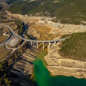
 We arrived on foot through the cut to vehicle track that starts in the coll d'Oreller near the Figuerassa, and close to the shrine of Our Lady of Corbera. The old pond basin, now almost without water, and the farmhouse, resting the foot of the eastern slope that descends from the highest part of the Rasos de Peguera. Pinares red pine and black pine as we gain altitude, which are a mine of chanterelles, pinetells and white Llenega, especially in light and fresh, and porcini, which bear fruit in the cooler corners near the most mature pines.
How to get
Follow the direction Rasos de Peguera by BV-4242 and BV-4243 road. Halfway, you will find to the right an indication that says Espinalbet. Follow this road about two kilometers and a half to reach the area of the pine forests of l'Estany. GPS coordinates: 42.132222, 1.810334
El Serrat of Comes (Baix Berguedà)
 The transit zone between the valley of Llobregat and lost some notable Lluçanès forests following wildfires few years ago, but still retains good samples of plant landscape where you can enjoy the best day mushrooms. In this proposal, near Prats de Lluçanès and the baga of Casanova at our feet, good mushroom crop in a typical forest area dominated by pine needles, red pine and oak trees. Land, loaded with lime, allow the appearance of species such as the black higróforo and white ox tongue, and obagosa guidance meets the needs of camagroc.
How to get?
Exit Gironella north of the C-16 and follow the C-62 to Prats de Lluçanès. Enter the village, continue on the Pau Casals Avenue and turn right onto East. At the height of the Rock Street Bras you will find the road leading to the Serrat of Comes GPS coordinates. 42.013623, 2.009607
The pine forests of the Plain of Montclar
 Sawed between the Verdeguer and Can Matosa, on the slopes leading down to the stream of Montclar, good forest fragments are preserved; further south, past fire?? punished enough habitats. Here, the pine forest of pine and red pine, festooned with some oak trees in the cooler places, offers from black chanterelles Llenega up blood, through the camagrocs, ox tongues of white and purple pimpinelles. The modest altitudes, situated between the heights of 700-800 meters, suggest mushroom blooms that often start in early October and extend through November.
How to get?
From the C-16, take exit Berga center and continue towards Avià and then towards Solsona. in L'Espunyola, you will find a detour to Casserres and Puig-Reig. Continue about 2 km until you see the indicator and Advance Can Codina 500 m. GPS coordinates: 42.034664, 1.773936
Marsh l'Espunyola
 When we got to the plateau of Capolat have the feeling of entering into a kind of forest, nice garden and good - looking. It is no coincidence, behind this landscape is the work of forest owners who have managed space for generations; therefore, we are aware of it, and respect the idyllic setting. We recommend getting to the point proposed by the track that starts at the foot of the cliffs, in L'Espunyola. The environment of the swamp, located above 1,100 meters, with the sawed de la Llosa and Tombes at his side, is occupied by a fantastic pine forest of red pine rich chanterelles, but also in fredolics and camagrocs as that autumn progresses and the nights get colder.
How to get?
On the C-26, from Berga to Solsona, there is a turnoff to the right indicated that indicates "Camino del Pantano". Go forward along this road about two kilometers. GPS coordinates: 42.070632, 1.764667
El Serrat de la Vila
 We do not reach the 700 meters, which means that here the mushroom Floradas not begin in September as in the northern half of the region, but showing the first signs of mycological activity from mid-October onwards. Around Olvan are quite fragmented forest level, with many crops that limit the areas of forest, but there are a number of pine trees with oaks, and some oak and some red pine, in the field of Serrat de la Vila and place known as black Bac. We are in a calcareous soil, good producers of chanterelles, black Llenega, ox tongues of white, purple pimpinelles and even carlets under the oaks.
How to get?
From the C-16 northbound, exit at Cal Rosal, and at the fork, turn right in the direction Olvan and keep driving about two kilometers. GPS coordinates: 42.063807, 1.890205
Pratformiu and saw Mitges (Solsonès)
 We left on foot from the Coll de Jovells, located about 1,500 meters high and close to the site of the Terreres, in an area dominated by red pine and black pine presence of some clueless area. The road, which will disappear after a few minutes, brings us into the narrow ridge that stretches to the top of the Sox saw a splendid viewpoint of the Sierra de Guixers and nearby woods. It is a good option that allows us to make inroads into the two sides (north and south) depending on preferences. On the northwest side, wetter, mushrooms abound as pinetells or blanques llenegues. In the southeast are more frequent chanterelles, favored by thermal growth.
How to get?
We leave the C-16 Berga and continue to San Lorenzo de Morunys by the BV-4241 road. Before reaching Guixers, turn right onto a detour indicated as La Corriu and continue about 10 kilometers. GPS coordinates: 42.167817, 1.644482
What to do
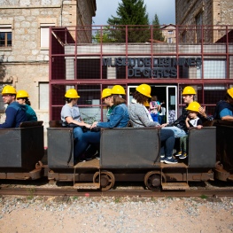
Museu de les Mines de Cercs
Cercs (a 4.2 Km)Dedicated monographically to coal, it is a museum of technique and history…
Museu d'art del Bolet
Montmajor (a 5 Km)The Museum incorporates more than 500 pieces of mushrooms duly cataloged by…
Where to eat
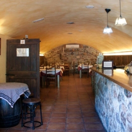
Hostal de Montclar
Montclar (a 4 Km)Located in the town square of Montclar, in the south of Berguedà,…
El Recó de l'Avi
Guardiola de BerguedàTypical homemade cuisine, with oak-grilled meats, a wide variety of tapas and…
Bar Restaurant El Jardí
Sant Llorenç de MorunysThe Bar-Restaurant El Jardí de Sant Llorenç de Morunys offers traditional cuisine…
Where to sleep
Hotel Casa Duaner
Guardiola de BerguedàThe Casa Duaner Hotel in Guardiola de Berguedà offers modern facilities, a…
Hostal la Muntanya
Castellar de n'HugFamily hostel located in Castellar de n'Hug. It offers various accommodation options,…


