


Municipalities
The Les Masies route joins the municipalities of Vilablareix and Aiguaviva, and connects with Girona Airport, in the municipality of Vilobí de Onyar.
- Kilometers: 6km
- Unevenness: 3.7% (with a maximum slope of 20%)
- Difficulty: minimal
- Flooring: Sauló and all-ú
- Altitude: maximum 166 m
- Altitude: minimum 124 m
This route, with a total of 5.5 kilometres, makes it possible to connect Girona Airport, a large mobility generating center, with the surrounding municipalities through a greenway, contributing to low-carbon, safe and sustainable mobility..
The municipality of Aiguaviva is a flat territory irrigated by the river Güell and with small hills. Its inhabitants have traditionally dedicated themselves to agriculture and cattle raising, and this agricultural tradition can be seen in the landscape with crop fields, surrounded by cork oak and pine forests, and the eighty farmhouses, currently all inhabited, that are located Along the way.
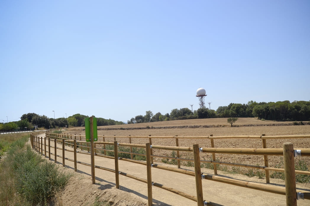
The Les Masies route also reaches the municipality of Vilablareix, which stands out for areas of natural interest such as the Can Xapes forest or the Sant Roc forest, as well as the three rivers: the Güell, the Masrocs and the Reremús. It also highlights its agricultural tradition.

Nearby experiences
Related routes
Path through the Capçana lock in Cassà de la Selva
Cassà de la Selva, Sant Feliu de Guíxols
Difficulty level: Easy Overall distance: 5.9km Starting point: Station It is an ideal route to do with the family in the hottest months. The Capçana or Verneda lock is a small reservoir that captured water from the Verneda stream to…
Circular route through the south of Gironès
Campllong, Cassà de la Selva, Fornells de la Selva, Girona, Llambilles, Quart, Sant Andreu Salou
Route: Girona - Quart - Llambilles - Cassà de la Selva - Sant Andreu Salou - Campllong - Fornells - Girona Start: Girona Route: Circular Distance: 37.5km Difficulty: Medium
Route of Carrilet II of Girona in Sant Feliu de Guíxols
Cassà de la Selva, Girona, Sant Feliu de Guíxols
The Ruta del Carrilet has a route of 41.9 km, with a gentle slope from Girona to Sant Feliu de Guíxols (15 m), and reaches the highest point in Cassà de la Selva (136 m). Following the route of the old Girona-Sant Feliu narrow-gauge…
Route through the fields of Esclet in Cassà de la Selva
Cassà de la Selva
Difficulty level: Easy Total distance: 12km Starting point: Station The route through the fields of Esclet is a route marked by the light and the colors of the seasons, where you will also discover a rich and diverse fauna and flora.
Events
Forest week in Sant Celoni
16 OctoberAmateur Theatre Showcase in Sant Gregori
16 OctoberEuropean Heritage Days in Collbató
16 OctoberRACC Costa Dorada Rally in Salou
From 16 to 17 OctoberZim Zam Cassà - Cassà de la Selva Urban Art Festival
From 16 to 17 OctoberEmbarrats Fair in Sant Joan de Vilatorrada
From 16 to 18 OctoberFish and Rice Gastronomic Days
From 9 to 18 October








 Sustainable turism
 Biosphere