Coastal paths: from l'Ametlla de Mar to l'Ampolla
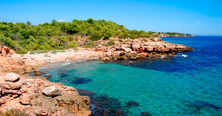
The itinerary proposed by femturisme.cat this month suggests that we follow the coves that outline our Mediterranean coastline, specifically the stretch that includes l'Ametlla de Mar, El Perelló and l'Ampolla. This stretch of coast is one of the most well protected and little altered in Catalonia.
The route starts at the Alguer de l' Ametlla de Mar beach and runs along the GR-92 path, which coincides with the coastal paths in this area. It is a low difficulty itinerary, doable as a family, which will allow us to refresh ourselves and enjoy the landscape environment and the natural value that make up each of the solitary coves that we find along the way and where the land and the sea, combined, offer us spaces of great beauty that invite us to soak ourselves.
The distance between l' Ametlla de Mar and l' Ampolla is 16 kilometers. These can be done in approximately four hours. Shall we start?
round roads
The roads of Ronda were used, in the past, by fishermen. The original reason for the creation of these was to communicate the different populations of fishermen on the coast.
With the war they began to occupy another function since they not only communicated different municipalities but were also used as a control network for the food black market. Currently, these paths have become spaces for walking and leisure.
La Cala, starting point
 To start the route we have to go to the municipality of l' Ametlla de Mar, a town in the Baix Ebre region. Arrived at this, we must look for the promenade to be able to access the Alghero beach. It is possible to park the vehicle on the promenade or on the road to the Port.
L' Ametlla de Mar is synonymous with the Mediterranean essence. No one separates the population from the sea. Just as her story does not exempt her. In addition, this municipality is also known as La Cala since along its coast there are several; with fine sand, stones, with crystal clear waters...
The origin of this population is due to the strategic point of the coast where it is located and, to the consequent function that it occupied until the 19th century as a defense against pirate attacks with the construction of defense towers. Around the year 1775, this space known as Cala de l'Ametlla was repopulated with fishermen from Valencia.
Today, l' Ametlla de Mar still retains the spirit of a fishing village that characterized it.
The coves near the Ametlla
 From the Alghero beach and following the fishing port we will follow the path to Cala Pepo, accessing by some stairs that are in the new fish market and close to the jetty of the yacht club.
In Cala Pepo, which is small and still semi-urban in nature, you go down until you touch the sea and after a few meters you go up some stairs again to follow the cliff and resume the Ronda path that leads us It will lead to the next cove and beach, Cala Bon Caponet and Bon Capó beach.
Cala Bon Caponet is ideal for relaxing and enjoying the tranquility that it gives off, since it is surrounded by an area of trees. It is fifty meters long and is separated from the Bon Capó beach by a passable ravine.
From Bon Capó beach, continue towards the Port of Estany Gras. To get there we must follow the coastal path that runs through an old shipyard.
The old natural harbor
 We will find the beach of Puerto del Estany Gras after going around the port of the lake and accessing it along the path of the coves. This beach was the old natural port where the fishermen left their boats, until the new port closest to the center of l' Ametlla was built.
On the northern side of the natural harbor there is still a small lighthouse.
This beach is two hundred meters long. Its ecological particularity is defined by the mouth of the Torrent del estany that rises on the Tivissa mountain.
From this beach you continue to Puerto Olivet, another beach located in the north of Cap de Santes Creus. In this there is an artillery bunker belonging to the Civil War in the rehabilitation phase.
To get to Santes Creus beach we will cross the entire beach until we find the coastal path again.
The Cap de Santes Creus, an area of natural interest
 Port Olivet beach is located in the northern part of Cap de Santes Creus. While in the south is the cove of Santes Creus. Both spaces are part of the Espai d'interès Natural (PEIN) of Cap de Santes Creus.
The Santes Creus cove, made of rock and pebbles, is of great ecological interest. This is far from the urban center and is 130 meters long and ends with a small pond.
Through it you reach Cala de la Llenya. This small cove is surrounded by pine forests and azabaras and is close to the Sant Jordi d'Alfama Yacht Club and the Ametlla de Mar Marina.
the last stretch
 The itinerary continues leaving the “El Hidalgo” urbanization on the right and resumes the Camino de Ronda crossing a ravine and passing near the remains of some trenches until it reaches the Estany Podrit cove.
This cove is characterized by fine sand and rocks and presents a virgin appearance. Its waters stand out among fishermen for its attractiveness since it is common to fish for crabs, both of the hermit species and of the green ones.
 The route returns to Punta del Àliga following, as usual, the coastal path to reach the Àliga beach, but before stepping on Roca del Illot.
La Roca del Illot is a small, beautiful peninsula. Through the stairs that are to the north of it, you can access the Àliga beach, where our outcome is located.
Àliga beach is located on the border between l' Ametlla de Mar and El Perelló. In this is the tower that bears the name of Punta de l'Àliga and was built in 1598 as a lookout building. It is currently converted into a lookout. Therefore, taking a look from this can be a significant way to see part of these 16 kilometers of travel.
If we return to the path along the coast, we will cross the municipality of El Perelló and pass through Cala Moros, Santa Llúcia Beach, Morro de Gos Beach and Cala Buena, until we reach Barranco de Perales, where we will have to go up and go down some stairs to bridge the gap. Next we will enter Cap Roig Beach, already within the municipality of L'Ampolla, and we will cross Cala María and Cala Baconé, until we reach the center of the town of l' Ampolla, where we can walk along the final stretch from Ronda del Mar Street.
GR-92
This proposed itinerary is part of a section of the long-distance path, the GR-92, which is known as the Mediterranean path.
 This path crosses the whole of Catalonia, from north to south, along the coast linking the town of Portbou with Ulldecona. In addition, it is a part of the European path E-10 and has its continuity through France and the Valencian Community.
In the section that runs between l' Ametlla de Mar, El Perelló and l' Ampolla, the path coincides with the coastal paths that run between coves, beaches, cliffs and small urban centers. In addition, this is common with various sections of the trail since the coastal paths were common on the coasts.
As an anecdote about this trail we must go back to its creation and the origin of its name. This trail is named number 92 on the occasion and in commemoration of the 1992 Olympics since, in principle, another number corresponded to it.
What to do
Jardí Botànic Medicinal, Ecoherbes Park
L'Ampolla (a 1.6 Km)The Ecoherbes Park Medicinal Botanical Garden is a large natural area next…
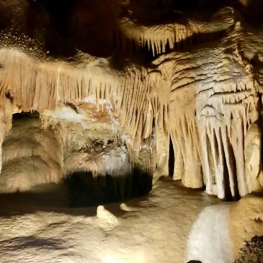
Coves de Benifallet
Benifallet (a 18.7 Km)One of the best-known tourist options throughout the territory, made up of…
Where to eat
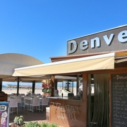
Restaurant Denver Cambrils
Cambrils (a 30 Km)From the legendary Xiri to the current restaurant, Denver offers a creative…
L’Estany - Casa de Fusta
Amposta (a 17.3 Km)A restaurant serving regional cuisine, with a wide selection of the ancestral…
Where to sleep
Hotel Ametlla Mar
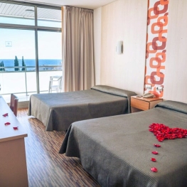
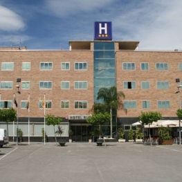
L'Ametlla de Mar (a 1.4 Km)The Hotel Ametlla Mar is located on the beachfront in the town…
Càmping Ampolla Playa - Taiga Delta de l'Ebre
L'Ampolla (a 1.8 Km)At the gateway to the Ebro Delta Natural Park, Camping Taiga Delta…
Càmping Alannia Costa Dorada
Vandellòs i l'Hospitalet de l'Infant (a 7.6 Km)Alannia Costa Dorada is located in an environment with direct access to…

