Vilallonga de Ter
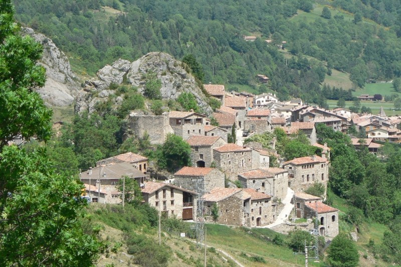
Vilallonga de Ter is a municipality in the Ripollès region, located in the Camprodon Valley, between Setcases and Llanars. It has an extension of 64.2 km² and is located at 1067 meters of altitude.
It is a very widespread municipality and corresponds to the villages of Roca de Pelancà, Abella and Tregurà. The latter with two neighborhoods: the Abajo and the Arriba. Around it develop the various neighborhoods of Vallvigil, Comalets, el Cros, Llebro and el Catllar.
Within the term there are two important power stations, one located in the core of Tregurà and the oldest in Vilallonga. The Vilallonga power plant, called de Brutau, was built between 1903 and 1909. The Tregurà power plant is much more modern and was inaugurated in 1961.
The "Routes of Villalonga: landscapes and culture" are itineraries marked and documented by the vicinity of Vilallonga de Ter. These itineraries are suitable for all types of public and combine nature with cultural areas of the municipality.
- Route of Les Fonts and the painter Joan Ponç: This route allows us to have an unbeatable panoramic view of the lower part of the municipality of Vilallonga de Ter.
- Ruta del Cabañas del Pastor: The route is characterized by the influx of a rustic and magnificent architectural heritage such as shepherd's cabins, buildings made of dry stone, a millennial method and a technique known in the agrarian world and characteristic of the countries Mediterranean
- Route of the Tregurà Channel and the Catllar Valley: The route follows a circular itinerary that allows us to have a wide view of much of the upper Ter valley, from Setcases in Camprodon.
- Route of the Bac de Vilallonga: It offers the possibility of knowing, treading and recovering a well-known and popular canyon among local and other ranchers in a time not too distant but that are now part of the history
The most noteworthy places of interest are: the Font Blanca and the Font Negre, the Wood Cross of Tregurà and the Parish Church of Sant Martí (from 1183, a church of a type not very frequent in the constructions of that time existing in the Ripollès).
Nearby routes
See all routes »What to do
Terra de Comtes i Abats a Sant Joan de les Abadesses
Sant Joan de les Abadesses (a 11.3 Km)Tierra de Comtes y Abats offers you a lot of proposals to…
Granja de cavalls i ponis, eQuillet
La Vall d'en Bas (a 24.6 Km)At the eQuillet Equestrian Club, we offer a wide range of activities…
Where to eat
Restaurant el Pont 9
Camprodon (a 4.8 Km)A restaurant serving humble and simple cuisine, where you can enjoy the…
La Santa Restaurant
Ribes de Freser (a 13.8 Km)Our fires cook locally sourced food, harvested using traditional methods. We support…
Hostal la Muntanya
Castellar de n'Hug (a 24.9 Km)Family hostel located in Castellar de n'Hug. It offers various accommodation options,…
Restaurant Dachs
Les Llosses (a 25.9 Km)Restaurant Dachs offers versatile spaces for celebrations in Les Llosses, with rustic…
Where to sleep
Càmping Conca de Ter
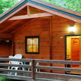
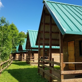
Vilallonga de TerThe Conca de Ter Bungalows are located in the Camprodon Valley, in…
Casa Etxalde
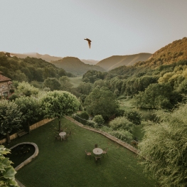
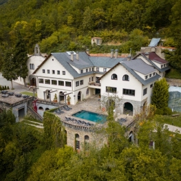
Camprodon (a 10.3 Km)Beautiful mansion built in the early twentieth century surrounded by green meadows…
Càmping Vall de Ribes
Ribes de Freser (a 11.5 Km)Enjoy Camping Vall de Ribes, where you can immerse yourself in the…
Angelats Hotel
Ribes de Freser (a 13.8 Km)Surrounded by an ancient forest, with wide paths to explore, the 20…

