Senan
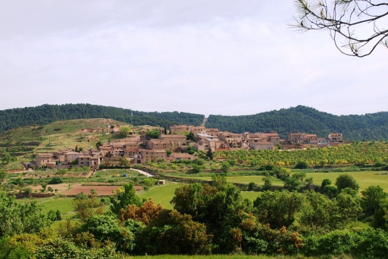
Municipality of Conca de Barberà, located on the western slope of the Sierra del Tallat, forming a molar between Urgell and Garrigues.
It is connected by the T 232 road, the Espluga de Francolí - Bellpuig, which crosses the term in a SN direction.
The municipal area has an area of 11.89 km², with a mid-mountain landscape and an altitude of 650 m above sea level.
The waters go to the slope of the Valley of the Corp.
The municipality is grouped around a hill on top of which was the castle. Currently three parts can be distinguished: the old quarter, elongated, and two suburbs, La Creu and La Font.
Nearby routes
See all routes »- The Cistercian Route, a genuine combination… (a 6.1 km)
- Grand Tour de Catalunya - Section 2.… (a 6.1 km)
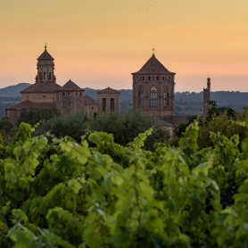
- Cistercian Route: gastronomy in Vallbona… (a 6.1 km)
- Tossal de la Baltasana or the Tower… (a 8.3 km)
- Route through Prades: nature, heritage,… (a 8.3 km)
What to do
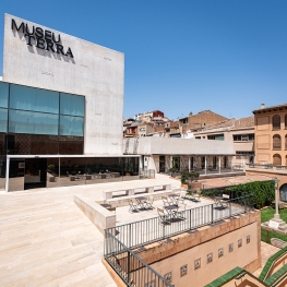
Museu Terra
L'Espluga de Francolí (a 8.4 Km)A visit to the Museum of Rural Life of the Carulla Foundation,…
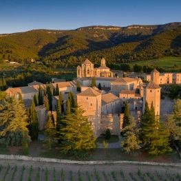
Reial Monestir de Santa Maria de Poblet
Vimbodí i Poblet (a 10.1 Km)A magnificent architectural complex located among the most prominent monasteries in Europe.…
Espai museístic del Cinema - Col·lecció Josep Maria Queraltó
Vallbona de les Monges (a 6 Km)This is the first space dedicated to the seventh art in the…
Where to eat
Iberik Rocallaura Balneari
Vallbona de les Monges (a 5.8 Km)Iberik Rocallaura Balneari is located on the Cistercian Route, in the municipality…
Where to sleep
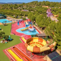
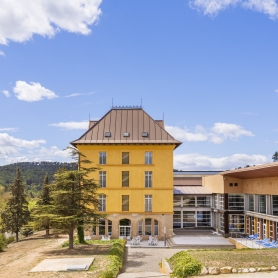
Camping Montblanc Park Capfun
Tarragona (a 13.2 Km)In the interior of the Costa Daurada, the Montblanc Park campsite offers…
Iberik Rocallaura Balneari
Vallbona de les Monges (a 5.8 Km)Iberik Rocallaura Balneari is located on the Cistercian Route, in the municipality…
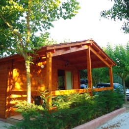
Càmping Prades Park
Prades (a 19.9 Km)Camping Prades Park offers an ideal setting for what most appeals to…
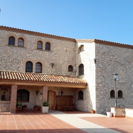
Mas Baldrich / Petit Mas Baldrich
Querol (a 25.1 Km)Mas Baldrich is a typical Catalan farmhouse built during the 19th century,…
Events
Experiences
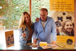
Discover the Monastery of Santa Maria de Vallbona - single entry…
Reial Monestir de Santa Maria de Vallbona (Vallbona de les Monges) (a 6 Km)