


Municipalities
A route to the highest peak of the Baix Camp and Conca de Barberà in the Sierra de Prades that offers us unique views and walks through one of the only two Pyrenean oak forests in Catalonia.
Tozal de la Baltasana or “the Tower” (Mountains of Prades)
- Difficulty: easy
- Slope: 260 meters of positive slope
- Time: about 2 and a half hours
- Kilometers: 8.5km
We leave from the parking lot of the Prades soccer field. It is located in the northern sector of the town, almost when it ends. From this car park, located on Calle Colomers, we will continue along the GR-171, which goes up to Tossal de la Baltasana. It will take approximately 1 hour (or a little less, depending on the pace) to reach the highest point of the Prades Mountains.
We will see that the GR diverts us to a street on our left (Juli Garreta street), recently paved. We will continue here until the urbanization ends and the forest track begins, just when we enter the forest. Next, we will find a detour to the left that we are going to take (GR marks).
We will enter a path that will gradually climb, without stridency, through a forest dominated by Scots pine and with some Pyrenean oaks. In fact, it is the only point in Catalonia where we can observe these Pyrenean oaks and we will appreciate that the leaf is something different.
The path above comes to a fork and we continue to the left. We go up looking at the marks of the GR-171 and punctually some yellow mark. We will arrive at a forest track that we will follow in a northeasterly direction until we cross the Coll de la Foguina, where we will see a panel that indicates the presence of Pyrenean oaks.
We will continue along the track in this shady corner of the mountain until shortly before reaching Coll del Bosc, where we will see a path to our right that will indicate the climb to Tossal de la Baltasana.

Foto: Camino de la ruta hasta Tossal d la Baltasana
We will face this last ascent through the western corner of the mountain until we reach the top of Tossal de la Baltasana, better known as "the Tower" by the people of Prades. At the top there is a geodesic vertex, a compass rose and also a small watchtower with signals, repeaters and a webcam/weather station.
From the geodesic vertex, protruding a little from the forest, you will contemplate the views of the surroundings: you will see the town of Prades below and, beyond, the Montsant mountain range. Some other peaks of the Tarragona region can also be seen, such as the Mola de Colldejou or the Mussara antennas. In the background, on clear days, you may be able to see the Puerto massif. On the other side, if the sky is clear, you will be able to see the Pyrenees, from Puigmal to Monte Perdido.
To return from the top, and complete a circular route to Cueva de Pere and Roca del Gríngol. We will descend from the top of Tossal by the opposite slope (direction East), along a forest track. At the end of the track we will find a chain and we will arrive at a crossroads on a small plain. To the left, you would return to the Coll del Bosc and turn the top to the shade. We will continue along the track in a North-East direction and still with the GR-171 marks.
Shortly after, we will leave the GR marks and continue along the track to the right (indicator sign for Prades and Poblet along the cattle trail). In fact, from now on you will notice some yellow and blue markings which are the ones that indicate the cattle path between Poblet and Prades.
We continue along this track that skirts the top and the Moleta plain to the south. Further on, we will see a small shortcut to the left along a path that we took. Simply, you would save a small curve in the track, so if you continued along the track you would still arrive at the same place. The path takes us to the Cueva d'en Pere, an old construction made under some large rocks and which is quite interesting to see.
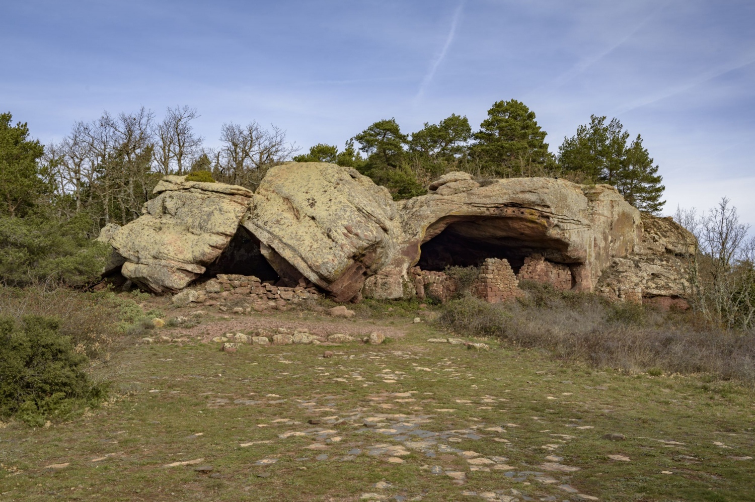
Foto: Cova d'en Pere
We return to the forest track until we reach a new detour with a sign indicating the Font del Mas d'en Pagès. At this point, we will do a little up and down to the Roca del Gringol, to have another perspective of the mountains. We then take this path to the left and immediately find a landmark and a small path to the right, somewhat less well-trodden, which is what takes us to the top. We will continue along this path until we reach the foot of the Gringol rocks. We climb this rocky cliff that rises above the red pine forest and enjoy the view that is offered from above. As the day is clear, we have come to see Montserrat above the fog, apart from all the surroundings of the Prades mountains.
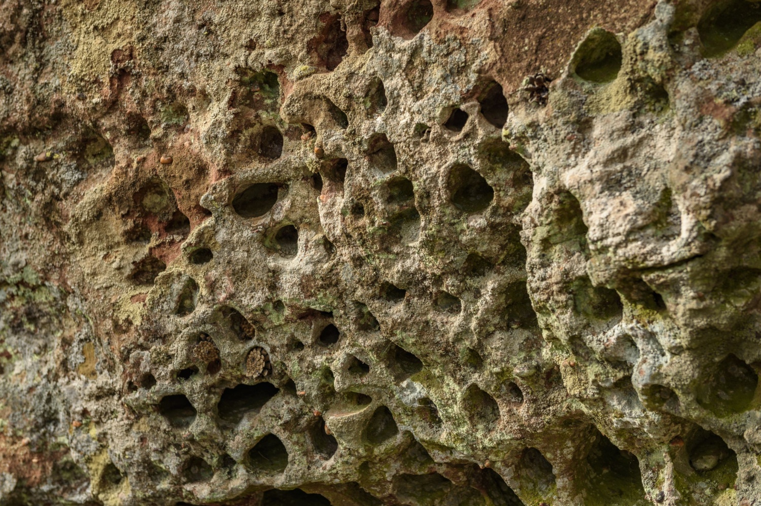
Foto: Erosión de las rocas a las montañas de Prades
We headed back towards the town. We undo the path from the top to the track and now we will follow it down, heading southwest along the Ganadero de Prades to Poblet path (signposts). You will almost always do the return on the track, except for a small stretch of trail. In any case, we will always pay attention to the stakes and markings of the cattle path (well signposted). We will go down the track that according to the ICGC is the Camí dels Plans and, further on, we continue along the Camí dels Colomers and Camí Vell de Montblanc tracks until we reach, after a while, the center of Prades, which we enter through the Virgen de la Abellera avenue that reaches the central road and the church of Prades. Once in the center of town, we continue along the main road (T-700) until we reach the car.
Author images and text: Sergi Boixader
Nearby experiences
Nearby routes
Astronomical observatory route of Catalonia
Àger, Albanyà, Esterri d'Àneu, Lladurs, Olivella, Prades, Pujalt, Sant Martí Vell, Sant Mateu de Bages
Looking at the sky has never been boring, there is not a single day that we find the clouds in the same position, we clearly observe all the stars or the moon shines equally. In Catalonia we like to look at the sky, and not only at a meteorological…
Route through the monastery of Santa María de Poblet
Vimbodí i Poblet
Have you not visited the Cistercian Monastery of Santa María de Poblet? We suggest a visit to this magnificent heritage building of our country, in the municipality of Vimbodí-Poblet, near the municipality of Espluga de Francolí.…
Cistercian Route: The Poblet Monastery, history and present
El Pla de Santa Maria, L'Espluga de Francolí, Montblanc, Rocafort de Queralt, Vimbodí i Poblet
This Cistercian Route, refers to the monastery of Poblet, located in the interior of the Catalan regions, in the Conca de Barberà region. We will get closer to both the monastery and the secrets that the surroundings hide, with a strong…
Route through the Baix Camp
Alforja, Arbolí, Botarell, Capafonts, Colldejou, L'Argentera, La Febró, Prades, Pratdip, Riudecols, Vilanova d'Escornalbou
The Baix Camp hides four small countries side by side, four well differentiated landscapes with a thousand and one mountains that constitute a natural amphitheater overlooking the sea: the rocky Mediterranean mountain of the Sierra de Llaberia,…
Related routes
The bay of Roses from an eagle's eye view
Roses
This is a very typical hiking route in the Alt Empordà region due to the magnificent views it offers us. Once at the top of Puig de l'Àliga (463 meters), on one side you can see to the south, the beautiful bay of Roses, and if…
Volcanoes and other landscapes in La Garrotxa
Besalú, Castellfollit de la Roca, La Vall d'en Bas, Olot, Santa Pau
The region of La Garrotxa is located at the eastern end of the Catalan Pre-Pyrenees and is known as the volcanic area of ??Catalonia. Its geographical location makes it attractive both for its proximity to the sea, the coast of L'Alt Empordà,…
La Muga Nature Trail, from the Mediterranean Sea to the Pyrenees
Boadella i les Escaules, Cabanes, Castelló d'Empúries, Peralada, Pont de Molins, Sant Llorenç de la Muga
The Muga Nature Trail follows the course of the Muga River and connects different Natural Areas of Girona, such as the Alta Garrotxa Area of Natural Interest (EIN), the Salinas EIN, the Muga Penyasegats EIN and the Natural Park of the Aiguamolls…
Routes through the plain of Aigüestortes
La Vall de Boí
The plain of Aigüestortes is a totally flat place, with forests, meadows and water, where we find a circular itinerary of wooden footbridges, adapted for wheelchairs and for people with functional diversity. We propose three itineraries,…
Events
Forest week in Sant Celoni
16 OctoberAmateur Theatre Showcase in Sant Gregori
16 OctoberEuropean Heritage Days in Collbató
16 OctoberRACC Costa Dorada Rally in Salou
From 16 to 17 OctoberZim Zam Cassà - Cassà de la Selva Urban Art Festival
From 16 to 17 OctoberEmbarrats Fair in Sant Joan de Vilatorrada
From 16 to 18 OctoberFish and Rice Gastronomic Days
From 9 to 18 October
News








 Sustainable turism
 Biosphere