The Salt River
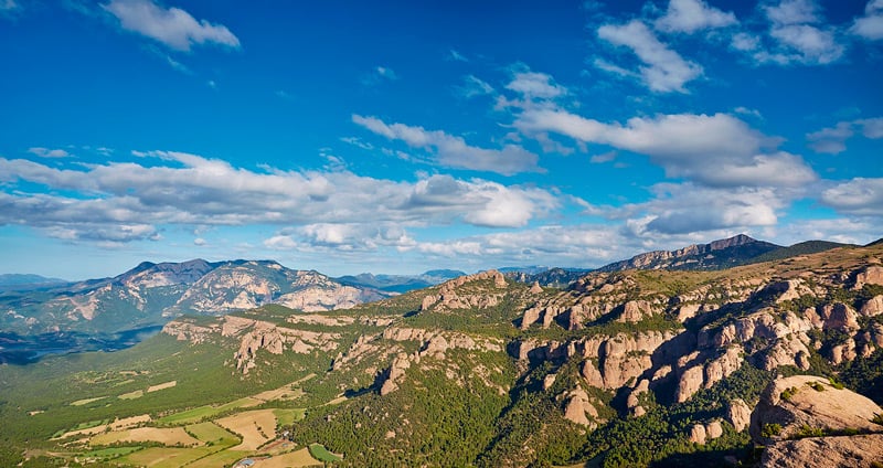
The Ribera Salada is a river that runs through the Solsonès, is born in the north of the region and ends up flowing into the Segre river. Places of great beauty surround the course of this stream, an area where the Solsonès changes its gentle orography for a more abrupt one, marked by mountains that are a prelude to the Pyrenees.
On this route we will take a tour of some of the places of the Ribera Salada but, also, we will visit the surroundings of the basin of this river, with extraordinary landscapes that we can observe from various viewpoints, we will also be able to know the origin of the name of this course of water that, as its name says, has a close relationship with salt even though it is very far from the sea.
Clop's bridge
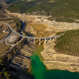
 To get to the Ribera Salada we will come from Solsona on the C-26, towards Bassella, and we will take the detour where the LV-4011 road begins towards Cambrils and Montpol, we will follow this road until we reach the Clop Bridge, the right point where the road crosses this water course.
 At this point in the Ribera Salada, the river widens and has created a wide plain on its side. In this place we can make a stop and take a walk through the surroundings, observe the waters of the river, one of the cleanest in Catalonia, or the ruins of the old hostel. The quality of the water, the shallowness of this section and the esplanade next to it mean that, during the summer, Puente del Clop becomes an inland beach that attracts bathers from Solsona and other nearby towns. Upstream we can see the serpent channel, a section where the passage of water has modeled the stones that surround the river with very curious shapes, gorges that make this section of the river a small gorge with rounded lines.
Montpol
 Returning to the LV-4011 road, we will pass by the church of San Miguel de Montpol, a building built between the 17th and 19th centuries, heir to an old church that has now disappeared, which was located, along with the castle, on top of the Rock of Montpol., a very peculiar large rock located next to the plane where the current temple stands, much more accessible than the previous one. At the foot of the rock you can still find traces of old houses that had been hideouts for bandits and smugglers.
The Serra-Seca viewpoint
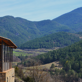
 Continuing along the LV-4011 road, towards the center of Cambrils, we will enter the municipality of Odèn and make a stop at the Serra-Seca viewpoint, located very close to the road. From the point where it is indicated to follow a path uphill and five minutes later we will arrive at the viewpoint. From there we will be able to observe a privileged panoramic view of the Ribera Salada valley but, in addition, we will also be able to see other places such as the mountains of the Port del Compte massif and the Sierra de los Obacs, with the Encantadas or Montserratina, rock formations that recall the characteristic forms of the mountain of Montserrat. At this point, at the foot of the road, there is also a monument in memory of the passage of the Tour de France, in the summer of 2009, along the road that borders the viewpoint.
The Cambrils salt mine (Odèn)
 After visiting the viewpoint, it will be time to learn about the close relationship between the Ribera Salada and salt. To do so, we will have to get to Cambrils, one of the centers of the municipality of Odèn, presided over by the church of Santa Cecilia and the ruins of the old castle, once there you have to go to the salt pan, this place is witness to one of the few mountain salt pans that existed in Catalonia. To get there we will have to cross the center of Cambrils along the LV-4011 road to the end and take the L-401 towards Coll de Jou, at kilometer 20 we will find the corresponding detour.
 Here there are some sources of salt water that, at the same time, are the origin of the Frío river and the name of the Ribera Salada. Despite having a high level of salt, downstream, this concentration is being diluted by the different tributaries of fresh water. But the most curious point of this area is its old salt pans, a vestige of what was a small salt-producing industry miles away from the sea coast. The history of production begins at the end of the 18th century and ends in 1963, producing salt for both livestock and human consumption. After the closure, the facilities remained unused for a long time, but a few years ago they were rehabilitated and, currently, they have been converted into a museum where the old process of salt production is explained and where salt-related therapies are also offered. Thus we can see the old water pipes, the mills, the old terraces where the water evaporated to collect the salt or, also, there is the possibility of bathing in the therapeutic saltwater pool with views of the Frío river valley.
The Cal Sala fountain and the Elefante Codro
 Once we leave the salt pans behind, we can continue along the L-401 road in the direction of Coll de Jou, we will soon find the Cal Sala Fountain located in the center of Racó, in this same place, very close to the fountain, we will find the waterfall de Agua de Cal Sala, a place where popular legends say that the water women went to comb their hair.
 Once past the Fuente de Cal Sala we can visit the Codro del Elefante, a large stone with shapes reminiscent of an elephant, to do so we will have to go to the hermitage of San Quintín, a small Romanesque construction that we will find hidden among oaks. To get there we will have to take the detour at kilometer 21.5 of the L-401 road in the direction of Coll de Jou, from which we will have to follow a 1.4-kilometre forest track that we will have to do on foot, along the way we will find a fork and then we will have to take the path to the left. Once we are there, 20 meters from the hermitage, we will find "the elephant" made of stone.
The Rock of Canalda
 Continuing along the L-401 road, we will approach the Canalda rock, a mountain that forms part of the Port del Compte massif and is visually characterized by its large rock wall, much appreciated by climbing lovers. At the foot of this wall are caves and stone shelters that have been inhabited since time immemorial, although no one lives today. Shortly before reaching the houses of the Canalda nucleus, at kilometer 36, we find a detour towards the "Can Rita" farmhouse, the last place on the rock that was inhabited. The construction, in ruins, is protected by a natural rock ceiling. This stone grotto was inhabited since prehistory but the house was not built until the 18th century, the construction owes its name to its last inhabitant who lived until the 80s of the 20th century. You can go inside where you can still see an old stove and a bread oven.
If we look at the house from the front we can continue to the right and take a walk along a section of the path that runs along the base of the Canalda rock, we can find other places that were once inhabited, such as the ruins of Ca Andreu, the The caves of Espluga Melera or, finally, the Cuevas del Moros, which can be seen elevated a few meters above, are not very accessible since they can currently only be reached by climbing techniques.
The trumfos (potatoes) of Odèn
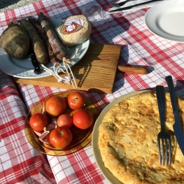
 The municipality of Odèn, made up of towns such as Cambrils, El Racó or Canalda, has one of its gastronomic specialties in the cultivation of trumfos. The trumfo del Alto Solsonès, grown at more than 1,000 meters above sea level, is a mountain potato with a special taste and qualities. Odèn has found in the trumfo an element to promote a peasantry that cultivates this tuber with natural and artisanal methods. This product can be found integrated into the gastronomy of the area, but one of the times of the year where it is most present is during the Truffle and Truffle Fair, held every March in Solsona.
Cruz del Codó viewpoint
If we return to the L-401 from the point where we were, we will arrive at Coll de Jou, from there we can drink the water from the fountain that is at this point and take a short walk to the Cruz del Codó viewpoint, in this place we will change for for a while the Ribera Salada basin through the Cardener basin, since from there you can see a panoramic view of San Lorenzo de Morunys, the Bastets conglomerates, the Busa mountain range, the Lord mola and the Cardener river at the height of the Llosa de Cavall reservoir.
The Castle of Lladurs
 After reaching the highest point, we will close the route by returning to lower lands, to the Castle of Lladurs. From Coll de Jou we take the LV-4241 road towards Solsona and when we find the Lladurs fountains picnic area, we leave the car and, from there, taking a walk, we can reach the castle. It is a construction with more than a thousand years of history that today is in ruins, along with the castle is the church of San Martín, the most visible and complete element in a set with parts from various eras, the oldest dating from from middle Ages. This old castle is located on top of a hill that allows us to finish the route with a privileged general view of the Ribera Salada basin and the south of Solsonès.
What to do
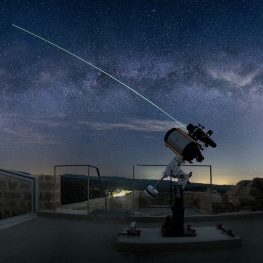
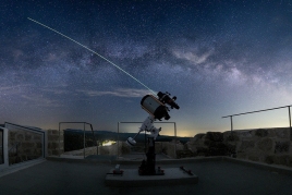
Centre Astronòmic del Castell de Lladurs
Lladurs (a 1.1 Km)The Lladurs Castle Astronomical Center will allow you to get closer to…
Centre cultural Espai La Vansa
La Vansa i Fórnols (a 13.2 Km)Espai La Vansa is a cultural space and mountain tavern in the…
Solsona Experience, descobreix el Solsonès
Solsona (a 5.6 Km)Experiential guided tours of the Solsonès region for all audiences, groups and…
Where to eat
Taverna de La Vansa
La Vansa i Fórnols (a 13.2 Km)A self-managed mountain tavern in Espai La Vansa, ideal for enjoying local…
Bar Restaurant El Jardí
Sant Llorenç de Morunys (a 12.2 Km)The Bar-Restaurant El Jardí de Sant Llorenç de Morunys offers traditional cuisine…
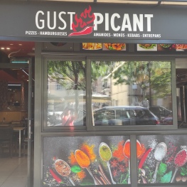
Restaurant Gust Picant
Berga (a 29 Km)At Gust Picant, you can enjoy affordable menus with a wide variety…
Hostal de Montclar
Montclar (a 21.5 Km)Located in the town square of Montclar, in the south of Berguedà,…
Where to sleep
Alberg La Rectoria de la Selva, Fundesplai
Navès (a 12.1 Km)The Selva Rectory is located in the municipality of Navès. This colonial…
La Torreta d'Olius
Olius (a 6.2 Km)Enjoy an authentic Catalan farmhouse, which was documented in the year 900…
Càmping Oliana
Oliana (a 9.5 Km)Enjoy an idyllic environment at Camping Oliana! Where you can stay in…
Càmping el Solsonès
Solsona (a 3.7 Km)Camping El Solsonès offers fully equipped wooden bungalows, a new camping area,…


