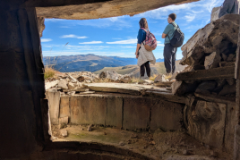
Semi-circular route in Tosa de Alp and Puigllançada
In the dividing range that separates Berguedà from Cerdanya, two of the highest and most spectacular peaks are Tosa de Alp (2,536 m) and Puigllançada (2,409 m). From a good part of the region you can see these two peaks that close the Berguedà to the north. Coronarlos is a simple excursion without any difficulty, but equally highly recommended due to its wide panoramic view on all four sides. A good summer option for typically "cow" peaks and with a much more solitary and cold aspect in winter to do with snowshoes.
- Difficulty: Easy. No notable difficulty.
- Elevation gain: 775 m accumulated ascent (470 m to the top of Tosa de Alp and 290 m to Puigllançada ).
- Times: 4h30' in total (with a half-hour stop at each peak) partials: between 1h10 and 1h25' to Tosa de Alp, 1h15' to Coll de Pal again, 30-40' to the top of Puigllançada and a half time to return to Coll de Pal.
- Kilometers: 11.1 km.
- Alternatives: This is the most direct access path to Puigllançada and Tosa d'Alp. However, the Tosa de Alp can be done from below, from the Coll de Pal Chalet-Refuge, from the Rebost Refuge or, through longer itineraries, following the Cavalls del Vent or Ultra Pirineo route. It would not be bad to do the Tosa de Alp also from the north, even if you have to cross the tracks of Masella. In the case of Puigllançada, you can also start from Coll de la Creueta or from the Molina-Alabaus car park.
- Access: We go up to Coll de Pal following the BV-4024 road that goes up to Coll de Pal from Bagà.
We set out from Coll de Pal towards the first objective of the day: La Tosa de Alp. If you prefer, you can start with the Puigllançada which is faster and shorter, as they would say, the order of the factors does not alter the product!
The ascent from Coll de Pal towards La Tosa, heading west can be done wherever you want. Certainly, the grass back allows you to climb where you see fit (The same happens with the Puigllançada ). However, you will see a small path with GR markings that you can follow during the climb. This is the GR-150.1, the variant of the GR-150 that goes around the Cadí-Moixeró. This variant follows the crest of La Tosa, Moixeró and Cadí up to Tres Canaletas del Cadí and Coll de Jovell.
The first section of the climb is the most demanding and steep. About 250 meters of unevenness are saved in approximately half an hour, until reaching the Rasos de Comabella. Precisely at this point the path goes slightly to the left to meet the route that comes from the south from the Rebost refuge and that is where the Cavalls del Vent pass.
We continue in a northerly direction and go up a few stony meters until reaching the Serrat Gran. Now we clearly see our objective, the Tosa de Alp and the shelter that crowns it, the Eagle's Nest. We descend a few meters to Coll de Comabella and go up again in a northwesterly direction following the path marked by the GR-150.1.
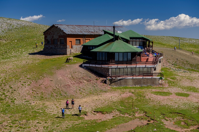
Once this unevenness has been overcome, now all we have to do is continue driving up gently until we reach the top of Tosa de Alp after about 15-20 minutes. As you will see, the top is very wide, it is the typical "top of cows" and it is quite humanised, with the Masella ski lifts, the Nido del Águila refuge and the antennas and repeaters towards the Ceretana slope.
From the top, the view on clear days is exceptional. You can see half of Catalonia and even some peaks in Aragon. To the south, Berguedà and Montserrat on the horizon. To the east, the Montseny, the Taga and the entire border ridge of the Puigmal in the Cambredase. And to the north, Cerdanya and the peaks of Carlit, Peric, Puigpedrós or Perafita among others. Towards the west, the Torreta del Orri can be seen in the distance and, on clear days, the Turbón, in Aragón.
To go down we could undo the same path, although we opted to make a small circular path to follow the southern slope of La Tosa, at half height. To do this, first we continue along the Cavalls del Vent route to the west along the path that comes out in front of the refuge (as if we were going to Peñas Altas del Moixeró ).
We lose a lot of height in a short time until we reach Coll de la Vall (or in some places it comes out as Coll del Puig de Mena ), where we turn left, heading south and take an old disused track. It is the Camino de las Minas, which leads to a building in ruins, the Cabaña de la Mena. It won't be necessary for us to get to the cabin. From Coll de la Font de Mena, the path becomes a path and we will now continue flanking flat or slightly descending to Collada de Comafloriu. This entire stretch has wide views to the south, looking at the Muntanyetes de la Tosa and the Gréixer valley.
It will take about 35-40 minutes to reach Collada de Comafloriu, a wide meadow and a crossroads. We pass a fence of the cows and we see the path of the Cavalls del Vent that goes up to the north. We will continue straight on in an easterly direction and after a while we will see a small path that is not well defined. We are following it although in the final part it blurs. All you have to do is continue through the meadows to the path that we have made up to the Rasos de Comabella. From here, we go down to Coll de Pal and now we opt to go up to Puigllançada.
The ascent to this pyramidal top has no secret and you can practically do it anywhere you want. There is a small trail with yellow markings and some milestones further up so that you have the reference point of the most direct straight route. Since it is making a rounded slope, the climb is somewhat treacherous, since we do not quite see the top until we are almost there. Approximately it will take us between 30 and 40 minutes to go up and about 25-30 minutes to go down the same stretch. The difference in level between Coll de Pal and the top is about 340 meters that we overcome from a spot. From above we have views equivalent to those of La Tosa, but more open to the east.
What to do


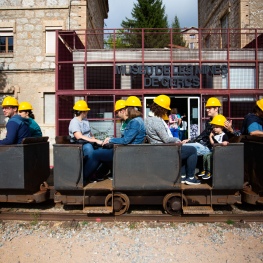
Museu de les Mines de Cercs
Cercs (a 7.8 Km)Dedicated monographically to coal, it is a museum of technique and history…
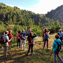
Penyes Altes Outdoor Services
Bellver de Cerdanya (a 11.3 Km)Discover new places and new adventures with the help of our team…
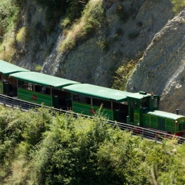
Tren del Ciment
La Pobla de Lillet (a 8.3 Km)Travel with the Tren del Ciment in a unique place where you…
Where to eat
Hostal la Muntanya
Castellar de n'Hug (a 13 Km)Family hostel located in Castellar de n'Hug. It offers various accommodation options,…
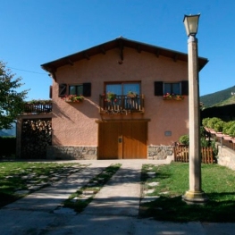
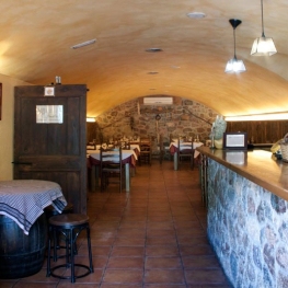
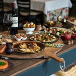
El Recó de l'Avi
Guardiola de Berguedà (a 2.4 Km)Typical homemade cuisine, with oak-grilled meats, a wide variety of tapas and…
La Santa Restaurant
Ribes de Freser (a 24.3 Km)Our fires cook locally sourced food, harvested using traditional methods. We support…
Where to sleep
Hostal la Muntanya
Castellar de n'Hug (a 13 Km)Family hostel located in Castellar de n'Hug. It offers various accommodation options,…
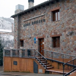
Hotel Casa Duaner
Guardiola de Berguedà (a 2.4 Km)The Casa Duaner Hotel in Guardiola de Berguedà offers modern facilities, a…
Restaurant Apartaments Els Roures
Castellar del Riu (a 16.3 Km)Rest, charm and good cuisine, a unique space located in Berguedà, at…