Route through the Puigsacalm from the Bracons pass
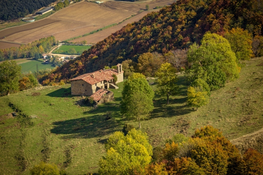
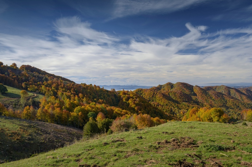
Puigsacalm is one of the essential peaks for hiking in Catalonia. At 1,515 metres, it is the highest point in the Transversal Mountain Range and is a great viewpoint of the Bas Valley, La Garrotxa and much of Central Catalonia. In autumn, the beech forests are dressed in a range of ocher colors and it is undoubtedly one of the best times to visit these environments.
- Difficulty: easy. No notable difficulty, just be a little on the lookout in the diversions and pay attention to the orientation on foggy days at the top.
- Height difference: 544m
- Time: between 3h30' and 4h30' depending on pace and stops
- Kilometers: 9.5km
- Variants: A circular alternative would be to start by going up the ridge, along the Tossells path and return along the proposed route. Similarly, the Puigsacalm can be done on the north side, from the valley of Sant Privat d'en Bas or from Joanetes, along the path of the Paso de los Burros.
Access
To get to the Collada de Bracons, we must take the BV-5224 road just before the entrance to the Bracons Tunnel coming from Vic. If we come from the corner of Olot, we will take the same road towards Joanetes del Valle d'en Bas. (On the Garrochino side, the road is called GIV_5273)
Route
From the Collada de Bracons, we begin by heading up a first rocky section (which, in fact, will be the straightest of the day) to take the path that enters the beech forest heading north.
During almost the entire route, we will follow the GR 151.1 marks of the Caminos del Obispo and Abat Oliba. We will also find yellow marks to the top.
We start walking among hazelnut trees and soon we enter a beech forest surrounded by boxwoods. This forest will be the clear protagonist until almost the top. If we go at the end of October, we will enjoy the reddish colors of the leaves. Generally, the Tots Sants bridge is one of the best times to go (it is also one of the busiest times).
After about 10 minutes from the beginning, we will find the detour to the right to go along the Tossells path. In our case, we ignore it and continue along the path that flattens through the beech forest. During practically the entire route to the Font Tornadissa, we will hardly make any difference in level, we will almost always go flat and it will not give us the feeling that we are climbing to a peak, it will be a good time to contemplate the beech forest calmly and tranquilly.
Continuing through the beech forest, after about 15-20 minutes we will arrive at the Collada de Sant Bartomeu, a small pass with a multitude of paths. Here we must be careful: we cross a small fence at the neck and turn right following the yellow marks and the GR. We will avoid the deviations to the left and forward where there are yellow signs in the form of a cross.
We continue through the beech forest planning and following the various commas that the mountain makes. This section is especially shady and wet. After about 20 minutes, we will find a detour to the right to go towards Font Tornadissa and Puigsacalm (signpost and yellow marks). We leave the track that continues ahead and continue along the path that takes us in about 5 minutes to Font Tornadissa, a perfect place to have a bite to eat.
From this point on, the beech forest ends and the climb up the Rasos del Manter begins. If the day is clear, we will have great views up to Pedraforca. In case of fog, we must watch the orientation, with a milestone and a sign. We go up to a forest track, cross it and turn right, heading East, until we reach a sign next to the forest. We now continue next to the beech forest until we reach a gate to cross the fence. We continue along the beaten path and enter the beech forest again to climb the last section to the top after about 20 minutes. On the way to the top, we will pass by the Collet dels Clivellers, where there is a signpost and the deviation that goes to the Pas dels Burros.
In the last meters before the top, we will leave the path that goes to Santa Magdalena and continue up until we reach the apex of Puigsacalm. From up here, we will have a splendid view of almost the entire Garrotxa, the eastern Pyrenees and a good part of the Gironès and Central Catalonia regions.
Before returning to the Bracons pass, we will make a second very easy summit: Puig dels Llops, which is about 600 meters further north of Puigsacalm. We will continue along the path that would go towards Santa Magdalena del Mont and we will climb the ridge that goes up to Puig dels Llops. From here, we will gain a great view of the corner of the valley of Sant Privat d'en Bas, with the hermitage of Santa Magdalena in the foreground.
To return, we will undo the path by which we came and on the way to the top of Puigsacalm, we can skirt it from below, without having to go to the top.
Photographs and text authorship: Sergi Boixader
What to do
Granja de cavalls i ponis, eQuillet
La Vall d'en Bas (a 14.1 Km)At the eQuillet Equestrian Club, we offer a wide range of activities…
Ratafia Bosch
Sant Quirze de Besora (a 6.7 Km)Come visit Ratafia Bosch and live the experience of discovering its history…
Where to eat
Braseria Les Comes
L’Esquirol (a 7.6 Km)Located on the premises of the Anigami Adventure Park, they offer menus…
La Santa Restaurant
Ribes de Freser (a 26.3 Km)Our fires cook locally sourced food, harvested using traditional methods. We support…
Restaurant el Pont 9
Camprodon (a 26.8 Km)A restaurant serving humble and simple cuisine, where you can enjoy the…
Restaurant Dachs
Les Llosses (a 17.3 Km)Restaurant Dachs offers versatile spaces for celebrations in Les Llosses, with rustic…
Where to sleep
Casa de colònies Les Codines, Fundesplai
Montesquiu (a 9.7 Km)Les Codines is located in the municipality of Montesquiu, in the Osona…
Casa de colònies El Company, Fundesplai
Vilanova de Sau (a 16.1 Km)Discover the El Company hostel, in the municipality of Vilanova de Sau,…
Càmping la Fageda
Olot (a 20.2 Km)The bungalows consist of two bedrooms, a bathroom with shower, a fully…
Càmping La Vall
Taradell (a 23.8 Km)Located on the outskirts of Taradell, in a beautiful valley where a…

