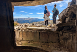
Obiols route in Avià by BTT
The proposed BTT route describes a route of low technical difficulty, although a bit long, through the municipality of Avià, in the southwest of Berga, through a very quiet and pleasant area between crops and small forests at noon in the Sierra de Queralt. Two magnificent Romanesque hermitages are visited: those of San Vicente de Obiols and Santa María de Avià.
Go?
You leave the Berguedà Regional Tourist Office, located on the C-16 road, km 96.20. To get there from Berga, you have to leave the south of the town on the C-26 as if you wanted to take the C-16 in the direction of Barcelona. Before entering the C-16, there are the signs for the tourist office and the Berga Resort campsite: it is accessed by turning left and crossing the highway below.
The route begins by undoing the access road to the tourist office in the direction of Berga (S). After crossing the Arroyo de los Molinos by a small bridge, turn left leaving the road and continuing a few meters in the same direction of travel (S). It describes a curve to the right followed by another to the left that crosses a small stream.
You have to continue to the right making a 90 degree turn (SW): going straight ahead you will reach the treatment plant. A few meters further on (1.26 km, 604 m), you will find a new fork and turn sharply to the left in a SE direction (later you will turn around at the right turn). You advance along a narrower path between crops.
We arrived at San Elías. A place where there is a but and some farms. Turn right downhill changing direction (SW).
Cross the BV-4135 road from Avià in Cal Rosal and continue at noon towards Graugés. Cross the stream of FONTCALDA and, leaving behind a group of houses, at the height of an upward curve, take a detour to the left (S) that begins a sustained ascent along a path in very good condition following the indications towards there is Gray and leaving some deviation to the left.
We arrived at Cal Gris's house. Leave the houses on the right and, at the next fork, surrounded by fields, turn left towards Obiols (E), starting a steep descent along a concrete track. Until after Obiols, it coincides with the GR 1 route.
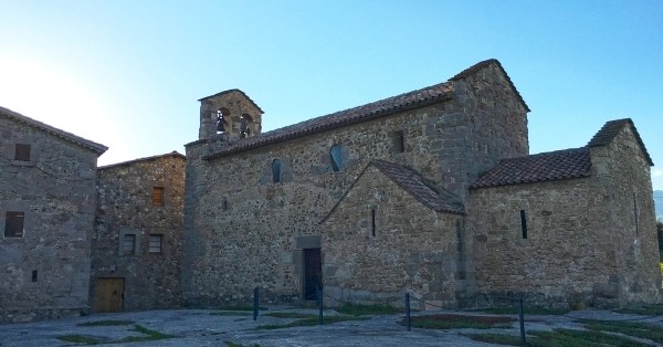
Obiols and church of pre-Romanesque origin of San Vicente de Obiols. Around, there is a great dispersion of anthropomorphic tombs with rounded ends that constitute a necropolis. We leave this historical complex on the left and go up slightly to the Collet de Obiols.
The Collet. In front of an extensive field, you come out to a small raised neck where the path forks: you have to get off on the right towards Graugés (W). A few meters further on, there is a new fork: continue to the left (SE) passing by the Bellús. It goes down a bit and continues to the right (O).
Bellús Mill. Bell place where the course of the Graugés stream makes a waterfall over some rocks. It is possibly the best place on the route to stop and rest. Attention! The itinerary leaves the most marked path, continues west and turns slightly north crossing this stream a few meters further to climb a less trodden path that enters through a small pine forest.
You come out onto a track, which you take to the right (N) to continue climbing. Continue along this partially cemented track between crops, oak and holm oak forests, stone slabs and scattered farmhouses. Good views to the north of the Ladrones and Queralt mountain ranges, and further up Avià and Berga. Although going up, the route turns west and south, passes by the side of Casanova del Collet and comes out onto a paved track that connects Graugés with Sant Pau de Casserres and where motorized vehicles are likely to circulate.
Crossing. You have to leave the asphalt track and continue to the right along a dirt road towards Bernades (W). A few meters later, it passes by Mas de Bernades and turns decidedly to the north, beginning the return to the starting point. A little further on, on a small hill, you pass the access to the colonias de las Viñas house on your right and continue in the same direction of travel (NW).
Vilamarí. In a place where there are some farms on the right, there is a fork: go up to the right (N), passing immediately next to Mas de Vilamarí. You go out again to an open area of crops and you access another hill, at the height of Cal Bernadí, with views of Avià and the Sierra de Queralt. You can see paragliders coming down from the neighboring hills, since Avià has two important centers and flight schools. The descent begins along the path known as the Avià Vilamarí path, in very good condition. Houses are left on both sides.
There are some houses on the left (there is Tana) and some farms in the background. At this point, you leave the most marked path, which bends sharply to the left, and continues straight (N) between the fields along a blurred path. A few meters further on, in a not very pleasant environment due to the presence of these farms, you turn right making a 90 degree turn (E). Soon you will reach Santa María de Avià.
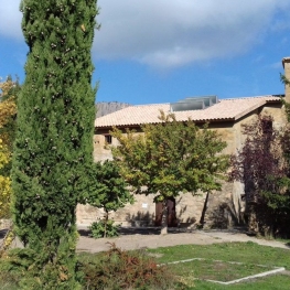
Santa Maria de Avià, located along the Avià road in Graugés. Small parish church with a single nave from the 16th century. XII with a beautiful altar frontal. You go along the asphalt road in the direction of Graugés (NE) leaving the temple on the right and, immediately, you have to turn left (NE) along a dirt road on the other side that descends, borders a house, which is a turn right, and it leads to a paved track that must be taken to the left (N).
Fork. After driving a few meters in a straight line along this track, leave it at the next curve and take a detour to the right (NE) that goes around the next houses on the left, crosses a small water course (FONTCALDA stream) and then crosses -you must go with caution- the BV-4135 road from Avià in Cal Rosal to continue straight. In the background, you can see the Virgen del Remedio: you will pass very close by running along flat roads with good views at noon that cover the lower Berguedà in Montserrat and the Montseny.
Crossing. After a short descent, you come out at a crossroads, turn left making a 90 degree turn (N). Fork. After a few meters, halfway down, you completely change direction to the right (E / SE) describing a very steep curve.
New fork. In a place where there is a large and modern house on the left, you will find the route at the beginning of the route (you have passed 1.26 km): this time, you have to continue to the left (NE) undoing the way to the tourist office.
Berguedà Regional Tourist Office, starting and ending point of the itinerary.
Source: Avià City Council
What to do


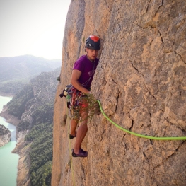
Octavi Guia d'Escalada
Casserres (a 7.4 Km)Meet Octavi Puntas Garcia, a great climbing guide where through ridges, walls…
Centre d'interpretació Dinosaures Fumanya
Cercs (a 11.6 Km)Discover the Fumanya Dinosaurs Interpretation Center and travel to the past in…
Guies d'Arrel
Berga (a 2.9 Km)Guías d'Arrel is a company dedicated to providing support to nature, with…
Where to eat
Bar Restaurant Xato
Gironella (a 6.5 Km)Order pizzas, burgers, tapas... at Xato Bar-Restaurant and we'll deliver them to…
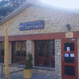
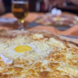
Restaurant Font Freda
Castellar del Riu (a 4.3 Km)A restaurant offering a wide selection of Catalan dishes, especially notable for…
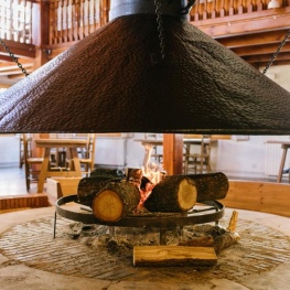
Restaurant Apartaments Els Roures
Castellar del Riu (a 4.6 Km)Rest, charm and good cuisine, a unique space located in Berguedà, at…
Where to sleep
Alberg Cal Pons, Fundesplai
Puig-reig (a 13.3 Km)Discover Cal Pons, a hostel that is part of the architectural complex…
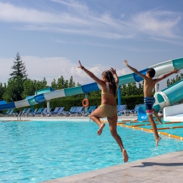
Berga Resort
Berga (a 3.3 Km)Tourist and sports center located in the Catalan Pre-Pyrenees (700 m high)…
Restaurant Apartaments Els Roures
Castellar del Riu (a 4.6 Km)Rest, charm and good cuisine, a unique space located in Berguedà, at…
Alberg La Rectoria de la Selva, Fundesplai
Navès (a 14.8 Km)The Selva Rectory is located in the municipality of Navès. This colonial…