


Municipalities
The Puig Castellar Ancosa route or blue route runs through the municipality of La Llacuna to show us some of the most emblematic elements of the town such as the Salto del Perro, the Coll del Corral, Puig Castellar or the Fuente de las Clotes.
Are you accompanying us?
We leave La Llacuna (height: 600m), on the way to Marimon, passing the Dorita farm towards Plaza España -2,150km- (height: 682m).
We continue until a detour -0.875m). We find a crossroads, where we can choose any of the three signposted sub-routes: Salto del Perro -0.350km-, Cueva de la Valldeserves -2.275km- and towards the neck of Corral -1.050km-. Once at this neck (height: 762m), we come across a new crossroads: Ancosa plain, ruins of the Cistercian monastery and monumental oak of Ancosa -2,250km-, or at Puig Castellar -2,200km-.
We follow the path with a steep climb to Puig Castellar (height: 945m). On the way down, we take a path on the left to a wider path that takes us back to the neck of Corral -1,925km-.
Now we follow the path to the right that goes down to the Masía de las Clotes, where we find a spring, 1,050km from the road, which is the Fuente de las Ranas and the El Niño mill. We arrive at the Torrebusqueta road, we will follow it until we reach La Llacuna -1,800km- again.
Source: La Llacuna City Council

Nearby experiences
Nearby routes
Paradise Forest in La Llacuna
La Llacuna
Simple and pleasant walk through the south of La Llacuna We leave the city of La Llacuna by the road of the deposits, following the path to the Cuitora fountain. We keep climbing up. On the right hand side, we follow the path until we find…
Route through the castle of Vilademager and the Fountain of the Plan Novell in La Llacuna
La Llacuna
Circular excursion through the municipality of La Laguna to see the castle of Vilademàger, and the Fountain of the Plan Novell. Go!
Tomb through the Sierra de Ancosa in La Llacuna
La Llacuna
The Sierra de Ancosa is a mountain range located between the regions of l'Anoia, Alt Camp and Alt Penedès. Through this route we will discover imposing places of this mountain range with a maximum elevation of 1002 meters on Mount Formigosa,…
Related routes
Route through the castle of Vilademager and the Fountain of the Plan Novell in La Llacuna
La Llacuna
Circular excursion through the municipality of La Laguna to see the castle of Vilademàger, and the Fountain of the Plan Novell. Go!
Transfilla Route
El Vilosell, La Pobla de Cérvoles
The Transllena route runs through the municipalities of La Pobla de Cérvoles and Vilosell. It enters the Sierra de la Llena, from where you can enjoy views of the Sierra del Montsant, a large part of the Garrigues region and the Conca…
Circular route through the wagon tracks in Ogassa
Ogassa
We propose a circular route along the tracks where the wagons circulated from the center of Ogassa to the Toralles station. The return can be done on foot and lasts approximately one hour.
Pala Alta from the Virgin of Montalegre
Camarasa, Les Avellanes i Santa Linya
This is a circular route through the Sierra de Mont-roig. We start the route at the hermitage of Montalegre. To get to this point, we will have made a forest track of almost 6 kilometers from the road that leaves Vilanova de Sal.
Events
Forest week in Sant Celoni
16 OctoberAmateur Theatre Showcase in Sant Gregori
16 OctoberEuropean Heritage Days in Collbató
16 OctoberRACC Costa Dorada Rally in Salou
From 16 to 17 OctoberZim Zam Cassà - Cassà de la Selva Urban Art Festival
From 16 to 17 OctoberEmbarrats Fair in Sant Joan de Vilatorrada
From 16 to 18 OctoberFish and Rice Gastronomic Days
From 9 to 18 October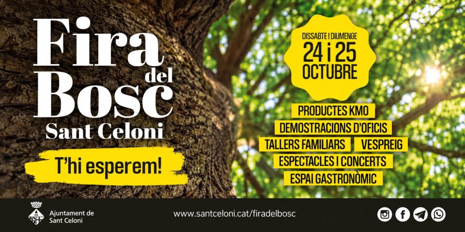
News








 Sustainable turism
 Biosphere