Walk to the Argençola ice well
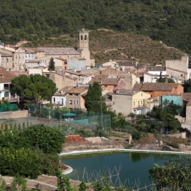
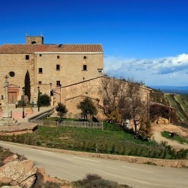
It is a short and easy, circular itinerary that we propose and that begins in the town of Argençola. At one time or another, before leaving, we recommend that it is worth climbing up to the castle and the square of the church of San Lorenzo, a privileged watchtower of the Alta Anoia.
The round trip itinerary is summit and, therefore, with wide views that go from the Pre-coastal Mountain Range to the Pyrenees. In the same way, you can see the surrounding villages that, like Argençola, crown the nearby hills, perched under the protection of the castle.
We will live closely the agricultural landscape of this part of the region, where its wavy relief forces it to alternate with the forest forming an attractive agroforestry mosaic. Thus, the fields of rain-fed crops, often terraced with high margins, draw beautiful shapes among the forest patches of the less favorable parts.
We will see masias, many also up on the summits, which remind us who is responsible for the maintenance of this landscape. Some, abandoned; others, active with new proposals to revitalize the tourism of proximity to the region.
Past Cal Rabasser and with a view of Cal Jepet and Can Serrats, on the other side of the valley, we go down to the channel of the Verdaguers stream, between fields of barley and clippings of a solana pine forest with aromatic plants that accompany us on the way.
Enter the channel of the stream, under poplars and maples, we will notice the freshness of these hollows to realize the change of vegetation between the sun and the shade. It is for this reason that we will find the ice well below. Ancient reservoirs and dispensers of cold centuries ago.
We will climb again, now crossing another shady pine grove where the aromatic ones have almost disappeared leaving room for other shrubs. We will go towards the road on the summit of Clariana, before the farmhouses of lime Jepet and can Serrats, where we can learn more about the flock of sheep of Can Serrats. The beautiful oaks between the two villages give us a clue as to what the forest could be before the pines spread out.
We return along the summit road towards Argençola, again enjoying the views in the direction of Santa Coloma de Queralt (speaker), the next neighboring district of the Conca de Barberà. We will pass by the side of a hill, above lime Macari, where some graves of slabs have been found, and then, on the side of Can Sebastià, which preserves an oven, now bricked up, integrated into the 1916 farmhouse.
Here at the summit, we can see some raptor typical of these open environments such as the kestrel or the buzzard, standing on poles or threads or fluttering through the fields looking for food. Passing by the side of the last houses before reaching the car, you can look at the swallows nests under the cornice of one of them.
What will we see during the route?
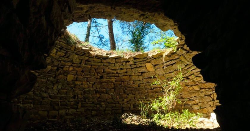
Ice well
 Do not get too close to the hole! It can sink.
The activity of ice wells is known since Roman times (2000 BC); Its great development took place between the sixteenth and nineteenth centuries, with a period of splendor in the seventeenth and eighteenth centuries and ending in the late nineteenth with the arrival of artificial ice industries. Until now, food preservation was carried out thanks to brine, fertilizers, preserves or the use of snow or ice.
Ice was used in the summer for the preservation of food, to fight fever, as an anesthetic, for burns, to stop hemorrhages, as a refreshing drink and to make ice cream. Construction of dry stone of cylindrical shape, and that currently lacks the entire dome. It has a lateral access, which was where the ice was extracted.
It is characterized, like most ice wells, by its location, in a shady and cool zone.
The farmhouses
Cal Jepet dels Pous dates back to the beginning of the 18th century, although it is not ruled out that in this place there was previously another building, since, as its name suggests, it was an area with abundant water resources.
An example of the water resource are these beautiful oak trees, characteristic of the freshest and wettest places. One of them next to a well. Opposite has Can Serrats. It has a flock of almost 300 sheep.
The production of organic quality sheep and know how to complement herd management with ecotourism activities are a clear example of the adaptation of this way of making new times. The municipality of Argençola is made up of seven towns and its population is scattered in isolated houses. Here is the importance of the hamlets in this agricultural territory. The towns, usually grew around and under the castle that crowned the hill.
Walls and orchards
 We are in the channel of the torrent of the Verdaguers. About 60 m downstream, on the right side, under some stairs that go down from the path of the shade, is the fountain of the Verdaguers. The spring is covered by a stone structure. Formerly it was the source of the town. We have not found it.
The pleasant sensation of freshness is provided by the poplars and maples. The walls that he sees with the door included the terraces closest to the stream where the people of the village had the garden. Here begins a vegetation very different from solana weeds.
It is a vegetation more than montane floor. In spring, March-April, between moss and ivy, the light that reaches the undergrowth through the bare cups favors the flowering of the hepatic (by the coloring of its leaves) of white flowers (photo), it could also have lilac flowers.
Flora: Pineda solana
 We are the country of the Carrascal (in the sun) and the Quejigo or Valencian (in the shady). Step between the Mediterranean dwelling and the mountain. The secular human activity domesticating the landscape made this forest disappear. Over time, the least productive and abandoned lands have been replanted to obtain new resources: wood and biomass.
The dominant forest is now the secondary pine forest (not autochthonous) of Aleppo pine (Pinus halepensis) in the solanas and pine (Pinus nigra) in shade. They grow on the undergrowth of the holm oaks and oak groves that should take their place.
Here, in the calcareous sun, we find a romeral and rudder dotted with beautiful junipers like the one next to the road (two white stripes on the small sharp leaves). The kermes oak, the jonquil and the ribbon are also made as dominant grasses.
In full sun, other aromatics accompany us on the way: the thyme, the evergreen embroidery and the female abrótano of pretty flower buds.
Flora: the corner
 Amelanchier ovalis Beautiful specimen right next to the inside of the giravolt. All the way that follows is bordered by the same bush. Some oak stands in the pine forest, testimony of the old forest.
The corner is from the Rosaceae family, like other shrubs we have seen: hawthorn, wild rose or rose hip; It is typical of calcareous terrains of the Mediterranean area or the mountain. Here we are in a space of transition between the two environments. Deciduous, take beautiful yellow colors in late fall. Traditional medicine attributes to the infusion of the bark with sodium bicarbonate properties such as hypotensive, diuretic, astringent and anti-inflammatory.
In the leaves are attributed hypotensive and antipyretic properties (to lower fever). The sap is used as a diuretic and antirheumatic.
Agrarian landscape

You face the typical landscape of the High Anoia that drains towards the basin of Òdena to the Anoia river. In the background, the buttresses of Montserrat and Sant Llorenç del Munt. Wavy relief formed by small crests, easily eroded forming the torrents that descend into the basin. The flatter and more suitable areas are used for dry cereal crops: wheat and barley.
Formerly, the steepest parts s'afeixaven with large margins of stone and cultivated rain-fed fruit trees such as almond trees, olive and vine. This today has disappeared turning everything into cereal, some rapeseed and some forage. In the steepest parts and of worse agronomic quality the secondary (non-autochthonous) pinewood dominates.
Other unproductive lands are scrubland and wastelands where soil quality, fires or livestock pressure have prevented the forest from developing. The alternation of plant textures, in harmony with the soft topography forms very attractive patterns, with curved lines.
Collaboration: City Council of Argençola and Joan Solà (Asociación el Trill)
What to do
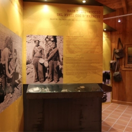
Memorial de l'Exèrcit popular
Pujalt (a 13.3 Km)The People's Army Memorial in Pujalt invites you to discover the history…
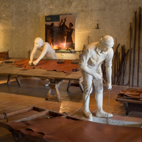
Museu de la Pell d'Igualada i Comarcal de l'Anoia
Igualada (a 14.2 Km)Throughout its history, the Igualada Leather Museum has become a benchmark for…
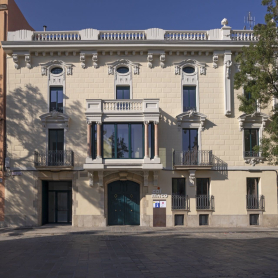
Cal Maco, Alberg i Centre de Visitants d'Igualada
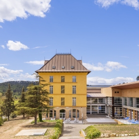
Igualada (a 14.3 Km)Cal Maco is a modernist building located in the center of Igualada…
Where to eat
Hostal de Pinós
Pinós (a 26.6 Km)It is the oldest restaurant in Catalonia that has never closed its…
Iberik Rocallaura Balneari
Vallbona de les Monges (a 27.6 Km)Iberik Rocallaura Balneari is located on the Cistercian Route, in the municipality…
Bodega Miquel Jané
Font-rubí (a 25.5 Km)Discover the world of wine with our comprehensive viticulture and oenology courses,…
Where to sleep
Masia Cal Mestre
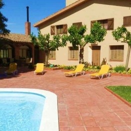
Sant Martí de Tous (a 7.2 Km)Masia Cal Mestre is a completely renovated 18th century house in Central…
Molí Blanc Hotel Igualada
Jorba (a 11 Km)Old paper mill dating from 1750, built on the banks of the…
Cal Maco, Alberg i Centre de Visitants d'Igualada
Igualada (a 14.3 Km)Cal Maco is a modernist building located in the center of Igualada…
La Torre del Codina
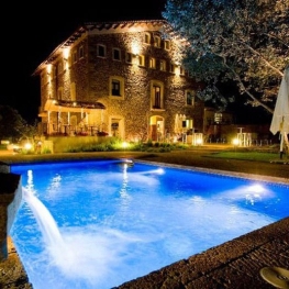
Tàrrega (a 22.2 Km)The Torre del Codina is located in the municipality of Talladell, municipality…


