La Muga Nature Trail, from the Mediterranean Sea to the Pyrenees
The Muga Nature Trail follows the course of the Muga River and connects different Natural Areas of Girona, such as the Alta Garrotxa Area of Natural Interest (EIN), the Salinas EIN, the Muga Penyasegats EIN and the Natural Park of the Aiguamolls del Empordà.
During the tour there is a connection between signposted routes such as the Salines Bassegoda BTT center, the Intinerànnia trail network and the Camino de Santiago. In its path, different habitats associated with the river are discovered, from the Ribera Forest to the river plains, thus joining the Pyrenees with the Mediterranean Sea.
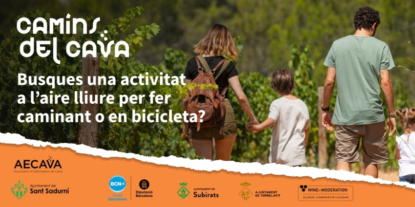
Along approximately 40 kilometers, the natural path passes through the municipalities of Castelló d'Empúries, Peralada, Cabanes, Pont de Molins, Boadella i les Escaules and Sant Llorenç de la Muga. This is a route that allows you to practice activities such as fishing, cycling or hiking.
- Modality: On foot, bicycle, on horseback.
- Difficulty: Low
- Distance: 40 Km
Route's villages
The itinerary begins at the mouth of the river in Empuriabrava, reaches Castelló d'Empúries, and continues to Vilanova de la Muga and Pont de Molins. The route continues to Boadella and Escaules and finally ends in Sant Llorenç de la Muga. Next we indicate the route by sections.
From Empuriabrava to Castelló d'Empúries
The building, called "La Colmena", on the beach of Empuriabrava is where the tour begins. You can see the mouth of the river Muga and the entire Gulf of Roses. On the horizon, the hiker will be able to recognize the rural landscape of Cap de Creus, a place of great scenic and cultural interest. During the first three kilometers of the route, the traveler can enjoy the views of the Aiguamolls del Empordà Natural Park, natural wetlands that are home to a great variety of bird species.
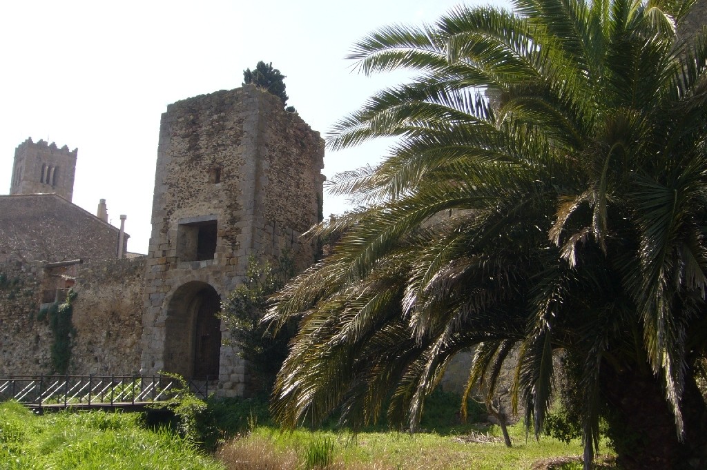
After five kilometers of leisurely walking we will arrive at Castelló d'Empúries, in whose streets and squares we recognize the passing of the history of the last 600 years.
It is advisable to visit the old wall and the Gallarda gate, as well as the cathedral and the La Farinera ecomuseum. Leaving the town towards Vilanova de la Muga, we find the link with the natural path, with informative signs that indicate our position and where we are.
From Castelló d'Empúries to Peralada
A flat walk begins that passes between cultivated fields until reaching Vilanova. Following the road that comes from the town, to the left, the river Muga is crossed by a concrete ford that is usually impassable in flood times (spring and autumn). Once you have crossed the river, you continue along the road to the right, along the right bank of the river
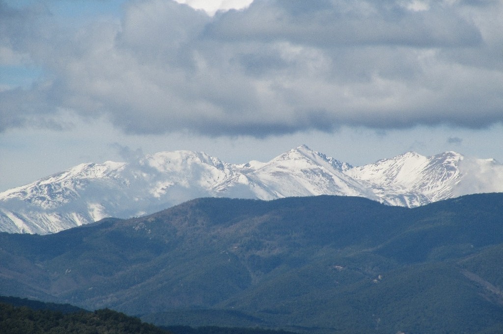
At about 500 m, the path leaves the road following the river and enters fields of crops and fruit trees. It is at this point, that if the day is sunny, you can see the Canigó mountain, the first great peak of the Pyrenees in French territory.
After some farms, the Camino passes under the railway line from Figueras to Porbou and the road that follows the same route. At about 200 m there is a rest area, in the municipality of Peralada, whose town is known for holding a music festival in the city's castle and the production of wines and cavas.
Although it is somewhat separated from the route of the Camino, it is worth going to Peralada and walking through its streets. Continuing the route along the river's butte, between reed beds, the road that connects Peralada with Vilabertrán and Figueres is crossed again, under a bridge.
From Peralada to Pont de Molins
Continuing the tour along the river bank, we will once again cross the road that connects Peralada with Vilabertran and Figueres, under a bridge.
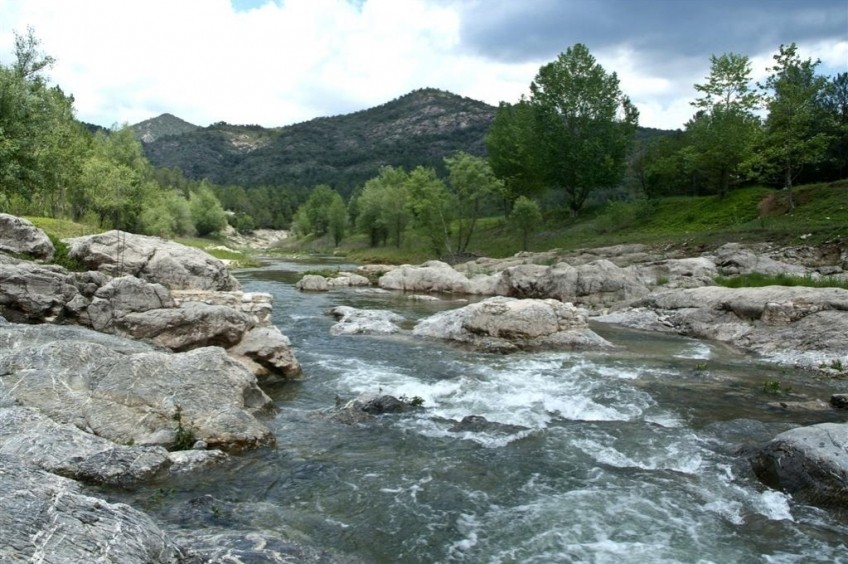
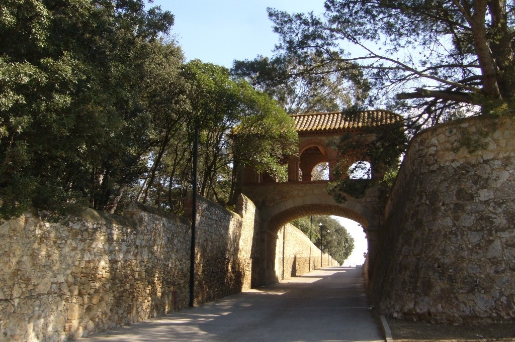
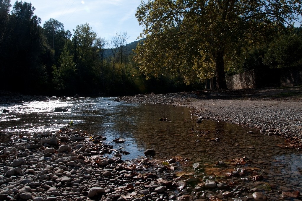
At about 500 m, the path runs through an area of riverside forest. It is an area where you can often see a specimen of otter (Lutra lutra). At this point, it is advisable to be extremely careful when crossing the river over the road bridge from Cabanes to Vilabertran and Figueres and following the route along the left bank of the river.
At the height where the river meets an irrigation canal, we can see the monastery of Sant Feliu de Cadins.
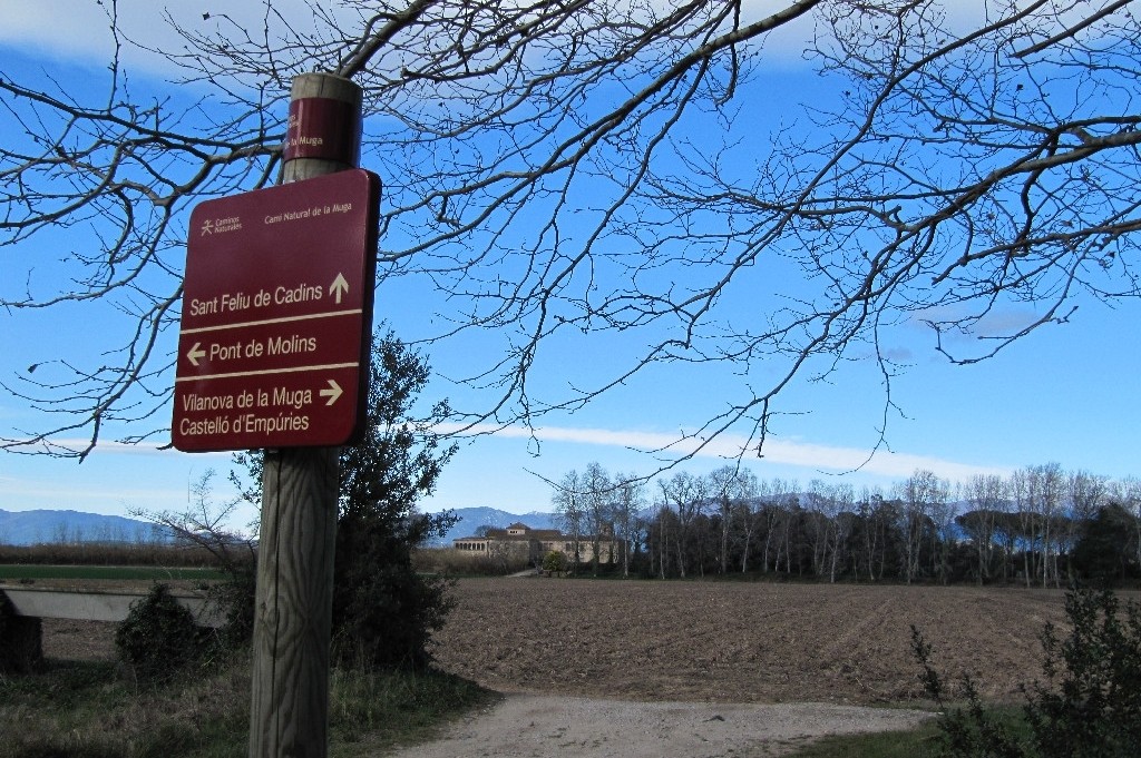
Following the river and after passing a couple of forks with the road signs, you have to continue under the AP-7 motorway that connects with France.
The path widens noticeably at this point. After about two kilometers turn left to find the river again and reach Pont de Molins.
From Pont de Molins to Les Escaules
Crossing the river over the road bridge, the path resumes on the right from where you can see the AVE train viaduct.
Before going under the immense infrastructure, there is an information sign and the first and best preserved lime kilns on the route. After about two kilometers, the Camino deviates to the right, becoming a path of great charm, where you can see from holm oaks ( Quercus ilex ) to lush gallery forests. A change in the landscape is evident, in transition towards the mountain.
As you advance, you will come to a small zigzag of the road until you find a footbridge over the river that leads to an old flour mill, very abundant throughout this section of the route. At this point it is advisable to rest and contemplate the river water falling in small waterfalls. Following the route, the Camino crosses the Boadella road and for three kilometers it crosses the riverside forest, and several farms with olive trees, vineyards and orchards.
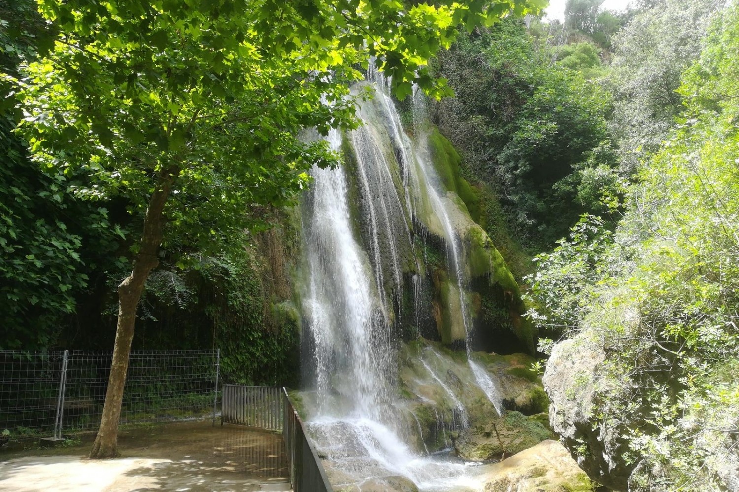
In the background you can see the neighborhood of Les Escaules, highlighting the medieval tower and a waterfall, which in the rainy season becomes a magnificent spectacle.
From Les Escaules in Boadella del Empordà
Very close to the waterfall, called La Caula, is the best preserved pou de glaç (ice well) in the entire area. In these holes, generally made in the rock, ice was formed and preserved, which was later used in houses or sold in the city.
The route continues upriver passing by a small dam and the Las Pulgas mill, an old flour mill, currently private property. Following the mill channel, the Camino passes through a concrete walkway and once a steel staircase has descended, it continues among the poplars and alders to the mill's water intake.
After two kilometers, you reach Boadella d'Empordà, a small but very pleasant town to walk, rest or eat.
From Boadella de l'Empordà to Sant Llorenç de la Muga
The Camino passes next to the schools and the town hall and heads uphill, looking for the road to Terrades. Crossing this road the Camino goes down to look for the river again. An old cobblestone recalls that this path has already been walked by others a long time ago.
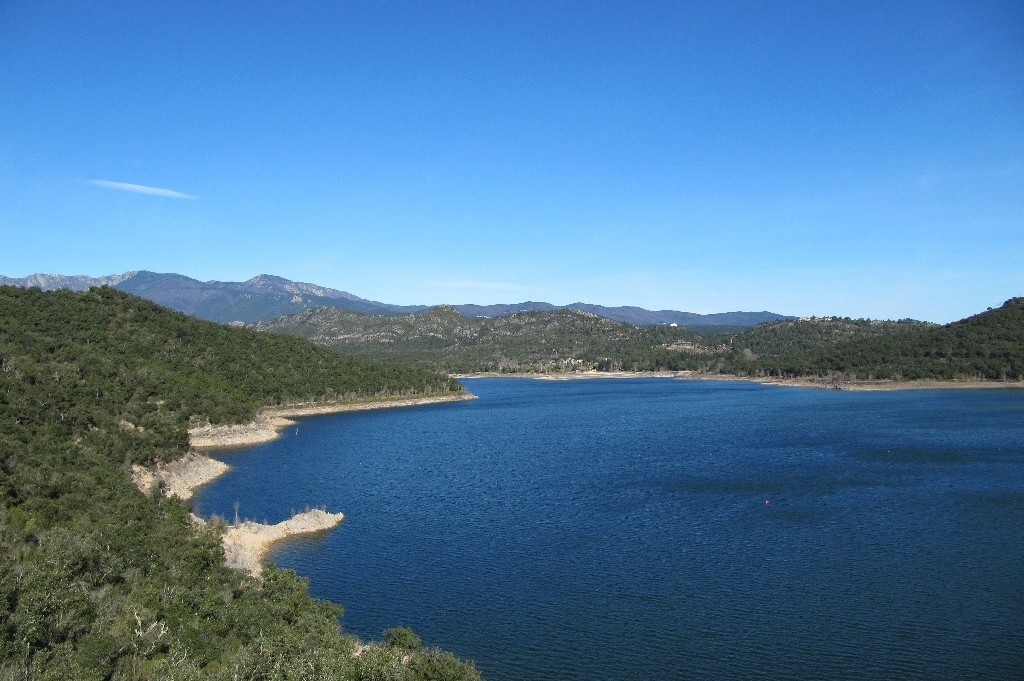
Crossing the river by the old stone bridge and you can see a rest area among banana trees (Platanus hispanica ). The Camino moves away from the river looking for the road to the Boadella reservoir dam. Following the road to the dam for about two kilometers, we face the climb to the viewpoint of the dam.
From this point and for about five kilometers, the difficulty of the Way increases considerably, although the landscape and the surroundings deserve this little effort.
At the top of a mound, you can see the hermitage of Santa Magdalena de Terrades. Strawberry trees ( Arbutus unedo ) and heather ( Erica sp.) Reveal the importance of the Mediterranean forest throughout this area. During the walk, you can see the reservoir and, protruding from the water in the dry season, the remains of old buildings.
After going down a concrete ramp, you access the head of the reservoir and once the valley widens, you can see the town of Sant Llorenç de la Muga, the end of the route.
Likewise, the Muga natural path allows us to connect with other circuits, such as the Itinerànnia network of trails, the GR-11, the GR-92 and the mountain bike routes (BTT) in the center of the Salinas -Bassegoda and the road to Santiago.
Source: Empordà Tourism / Ministry of the Environment
What to do
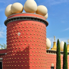
Teatre-Museu Dalí
Figueres (a 4.9 Km)Get to know the artist hidden behind the facade of his mustache…
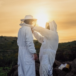
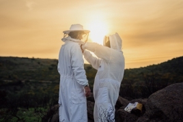
Abellaires Empordanesos
Garriguella (a 5.4 Km)Discover the world of honey with Abellaires Empordànese. A beekeeping company located…
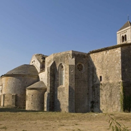
Canònica de Santa Maria de Vilabertran
Vilabertran (a 3.2 Km)Santa Maria de Vilabertran is, without a doubt, one of the best…
Where to sleep
Hostal Can Xicu
Capmany (a 6.6 Km)Can Xicu, restored in 2017, preserves the medieval feel of the house.…
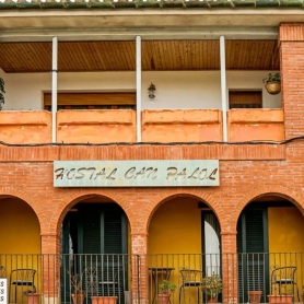
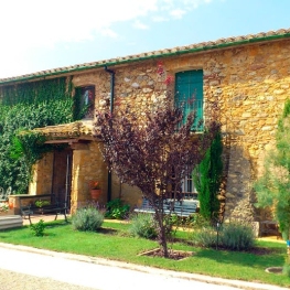
Hostal Can Palol
PeraladaLocated at the entrance of the village, just opposite Peralada Castle and…
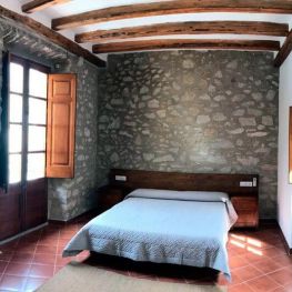
Mas del Joncar
Sant Pere Pescador (a 7.5 Km)The farmhouse is located in Sant Pere Pescador surrounded by fruit fields,…
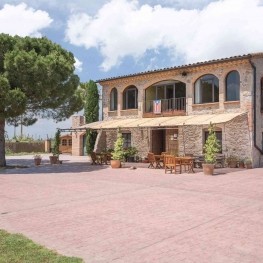
Can Jai Allotjament Rural
Peralada (a 10.9 Km)18th-century farmhouse in the village of Peralada. The 290 m² cottage is…