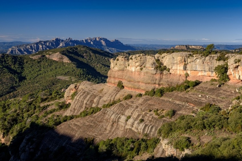
Montcau and La Mola from the neck of Estenalles

Few routes are more classic than this itinerary through the peaks of the Sant Llorenç del Munt and l'Obac Natural Park. La Mola is one of the most frequented peaks in Catalonia (if not the most) since it is an excellent watchtower of the Vallès Occidental and a large part of the Metropolitan Area of Barcelona. Montcau, for its part, is a great viewpoint of the Bages and the Pyrenees. The route through these two peaks can be an excellent morning to enjoy these mountains of the Pre-coastal Range.
- Difficulty: low. No special difficulty, route suitable for almost all levels
- Elevation gain: 501 m of accumulated positive elevation gain
- Time: between 3h15 'and 4h according to rhythm and stops
- Kilometers: 12 km
Variants: The classic route of La Mola through Terrassa is from Matadepera along the Camino de los Monjes or from Can Robert. If we would like to make more turns, we can also skirt at mid-height through the Castellassa de Can Torres area (east slope) or through the Canal de la Abeja (west slope). In the case of Montcau, we can also do it from the Marquet de las Rocas (Sant Llorenç Savall) passing through the place of the Simanya Cave. The round trip route can also add variants in the Òbits area, in the Sescorts Cave, to the Pinasses... in short, there are more paths than days to go through the entire Sant Llorenç del Munt y del Obac.
Access: From Terrassa, we take BV-1221 towards Matadepera. We can also border Terrassa on the outside through the B-40 until the junction with the BV-1221. We cross Matadepera heading north and follow this road until we reach Coll de Estenalles where there is a car park to leave the car. If we come from the corner of Manresa, we go towards Navarcles by the N-141c and we cross this town. The road that continues past Navarcles is the one that goes up to Coll de Estenalles (BV-1221) through Talamanca.
We leave the Estenalles neck car park, cross the BV-1221 road and take a paved track next to the information center. During practically the whole way, we will follow the Local Path SL-C 54 that goes from Coll de Estenalles to La Mola.
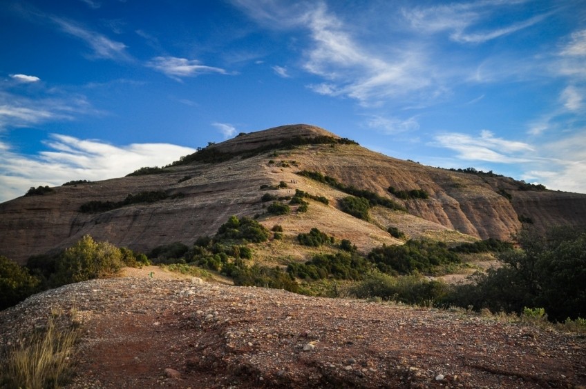
We start to climb this asphalt track for about 15-20 minutes until we find a fork on the left in the place known as Coll de Estella. We take this detour to climb Montcau (indicated) and we see another panel that warns us of the risk of erosion of the mountain and of the recommendation to avoid making shortcuts and we go through the path marked with ropes on both sides.
We progressively climb the southwest ridge of Montcau that will gradually make us climb to the top. Just before arriving, the last meters are somewhat straighter and we do some small climb without great difficulty.
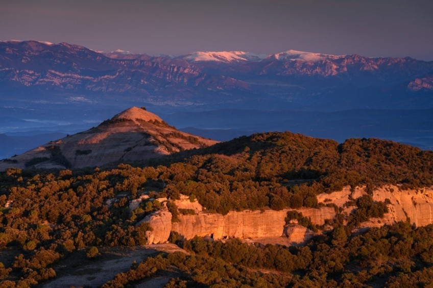
Once at the top, we enjoy a wide panoramic view of Central Catalonia and the Pyrenees. The mountain of Montserrat looks perfect and, at the bottom of the plan, the city of Manresa. Higher up, the foothills of the Pyrenees and the Berguedà Pre-Pyrenees. You can also see the Montseny Massif and, just to the south, the hermitage of Sant Llorenç del Munt stands out from the mountain. With the compass rose at the top, we will help to locate all these geographical elements.
To go down, we undo the last meters that we have climbed towards the top and now we will continue along the ridge that descends towards the southeast, towards the hill of Eres, where we will find again the track that we had left when we have deviated towards Montcau.
The neck of Eras is an important road junction and connection between Montcau and Carena del Pagès. Also among those who come from the neck of Estenalles and those who go down to the Simanya Cave and the Marquet de las Rocas. The 3 mountains route (Matagalls, La Mola and Montserrat) also passes through this point. Therefore, it is also easy for it to be a very crowded point. In fact, the entire flat ridge up to La Mola can be turned into an authentic pilgrimage some weekends at noon.
From the hill of Eres, we go up a few meters along the wide path from the old track. The forest is a lush and well-preserved holm oak grove, with some oaks that are stained in autumn and of which the Roble del Palau stands out, which we will find next to the path a little further on.
Before, however, in a small clearing in the forest, we will ignore a path that leaves on the left and that goes towards the Fogueroses and the overlapping Rock. We will always look at the marks of the SL-C 54 that we will find and ignore the various detours that appear to the left and right. If we look closely, we will also see some old red dot markings.
After passing the shady area and the crest of the Roble del Palau, we descend a few meters in a southerly direction, directly along a rocky section or bordering it on the side by a small path and continue along the ridge of La Carena del Pagès, altering sections planning with small ascents and descents.
Further on, the Collet de los Tres Terms, we will find another detour on the left that goes towards a clearing in the forest. We ignore this deviation to the left that would take us towards the ridge above the Òbits. We continue straight ahead, following the indications of the SL-C 54 and we descend a rocky section. After this descent, we ignore another detour to the left that would take us to Òbits.
We continue along the path bordering the Cerro de en Griera to the west and pass a stretch of forest until we reach Morral del Dragon, a well-known cave on the north slope of La Mola. Shortly before, we will have found a path on the right that would bring us closer to the Sescorts Caves.
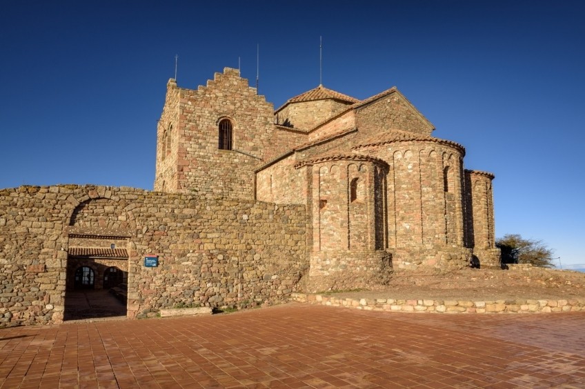
From Morral del Drac we follow the signs for SL-C 50 and 54 and avoid the path that passes through the Abeja channel towards Can Robert. We head diagonally through a rocky section without difficulty and enter a shady channel where the paved road is to overcome this rocky spur of the mountain. Once we have climbed this step, we reach the upper plane of La Mola and now we will only have to finish reaching the top at the Monastery of Sant Llorenç del Munt. From this viewpoint, there are magnificent views of the middle of Catalonia and, if we are lucky, some winter days (very few), even the Sierra de Tramuntana de Mallorca can be seen. It is already quite true that the world is very small!
To return, we will undo the same path that we have followed up to here, with the only variation of the Montcau section, which we will skirt along the track below. From the hill of Eres, it will not be necessary to climb it again, but we can follow it on the southern slope through a dirt and cement track until we find, again, the asphalt track that goes down to the pincer neck, where we have our car.
Image and text authorship: Sergi Boixader
What to do
Balneari Termes Victòria
Caldes de Montbui (a 9.8 Km)At the Balneario Termes Victoria Hotel we want you to feel at…
Cim d'Àligues
Sant Feliu de Codines (a 9.6 Km)Center specialized in raptors. The flight session and the guided tour of…
Museu Internacional dels Titelles de Catalunya, Masia Can Falguera
Palau-solità i Plegamans (a 14.2 Km)Discover the International Puppet Museum of Catalonia, a space for discovery and…
Where to eat
Taverna ümet
Sabadell (a 14.9 Km)Taverna Ümet is a restaurant in Sabadell offering creative tapas and flavorful…
Restaurant Marisquer Can Ladis
Sant Fruitós de Bages (a 10.2 Km)The Can Ladis Seafood Restaurant, located in Sant Fruitós de Bages, is…
La Calma, el Bellver
Tagamanent (a 19.5 Km)At the Masía Restaurante El Bellver, from 1:00 p.m. to 3:30 p.m.,…
Where to sleep
Alberg Viladoms de Baix, Fundesplai
Castellbell i el Vilar (a 12 Km)Viladoms de Baix is located in the municipality of Castellbell and Vilar,…
El Racó d'Artés
Artés (a 11.1 Km)Discover El Rincón de Artés or enjoy an unforgettable experience in the…
Hotel Molí de la Torre
Bigues i Riells del Fai (a 12.2 Km)12 double rooms and a junior suite, a meeting room, ideal for…
Càmping l'Illa
Sant Quirze Safaja (a 10.2 Km)Surrounded by nature, in the middle of the mountains at an altitude…


