Lo Pallars Fer, a route through the Natural Park of the High Pyrenees
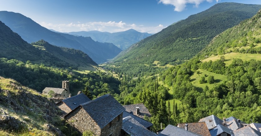
Lo Pallars Fer is a hiking route through the Natural Park of the Upper Pyrenees, the Natural Park with the largest extension in all of Catalonia that still brings together a genuine sample of the values of the high Pyrenean mountain to preserve.
Along its trails we can enjoy wild valleys, meadows with cattle, deep forests, riverside paths, beautiful villages, huts and hermitages, hills with fantastic views of the Pallar valleys, iconic peaks such as Monteixo or Pica de Estats and large panoramic views of the Aigüestortes National Park and Lake San Mauricio.
The old paths are the thread of memory, they allow us to discover the valuable territorial legacy through which we walk. Walking slowly, we can let ourselves be carried away by sporadic encounters with the local population, breathing in the life and history of Pallars.
By walking Lo Pallars Fer we contribute to creating responsible and sustainable tourism, energizing and diversifying the local economy.
Data sheet
- Season: from May to November (the rest of the year you can find snow somewhere on the route).
- Recommended duration: 5 stages.
- Distance: 77 km.
- Positive difference: 5,610 m.
- Negative difference: 5,400 m.
- Difficulty: Lo Pallars Fer is a self-guided hiking route that runs along trails and medium-mountain trails. Technically there are no difficulties, but due to its route and unevenness we can say that it is a medium-high level route that requires good physical condition and being used to walking in the mountains.
Signposting of the GR or PR trails
Lo Pallars Fer is a route that has its own signage, which can be found on some flags and signs located at the intersection points of roads.
During the route you will find other types of signs, which are identified as GR or PR routes.
- Small Route Trail (PR). Yellow signage. A line.
- Long Distance Trail (GR). Double signage in white and red.
Despite the fact that the route is signposted, it is important to have experience in the mountains, to have a map of the area and notions of orientation, while it is very interesting to use the route track when we have doubts.
Day 1. Paths with history. From Llavorsí to Burg
 We start the route in Llavorsí by a beautiful path along the river that gives us access to the Coma de Burg valley, passing through the towns of Tírvia, La Glorieta, Alendo, Farrera, small mountain villages where you can enjoy the tranquility of the authentic Pallars.
We can know the repercussions of the Civil War in the valley, because Tírvia was a population that suffered severely from the Pallars Front during the war.
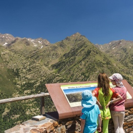
From Farrera we can go up to the Coll de So viewpoint, where we enjoy a fantastic 360º panoramic view of the Pallars mountains and valleys. From the viewpoint of the neck of So we start the descent to the town of Burg, the end point of the stage.
Data sheet:
- Signage: yellow markings / banners / route logo
- Distance: 16 Km
- Positive difference: 1,350 m
- Negative difference: 850 m
- Overnight stay: Burg
Day 2. The iron forest. From Burg to Alins
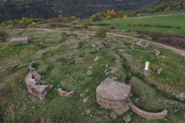
 We start the second day going up to Farro, an old republican camp located in the middle of the forest and from where we enter the Virós forest towards the Gall Fer refuge, where an interpretive itinerary on the exploitation of iron in the valley will allow us to understand the repercussions of human activity on the landscape.
Walking through the forest we can enjoy a variety of trees: pines, firs, birches, beech,..., until we reach the edge of Virós, the point from where we descend to Vall Ferrera and the town of Alins, where we can visit the Ecomuseum of Casa Sintet, a museum space in El Hierro, which tells us the history of the foundries in the valley and in Catalonia.
Data sheet:
- Signage: yellow marks / flags / route logo / milestones
- Distance: 18 km
- Positive difference in altitude: 960 m
- Negative difference: 1,200 m
- Overnight stay: Alins
Day 3. Nequa, a haunted meadow. From Alins to Esterri de Cardós
 Stage full of landscape contrasts that goes up the Eixerto Valley through a beautiful and winding cattle path that makes its way between the rocks to the high meadows and the Borders of Eixerto.
From Eixerto we cross the Cardós Valley through the Besan Valley and the Llano de Nequa, a magical alpine meadow from which to contemplate the surrounding mountains, valleys and forests.
From Nequa we go down through the Mata de Esterri forest to the small town of Esterri de Cardós.
Data sheet:
- Signage: yellow markings / banners / route logo / milestones
- Distance: 16 Km
- Positive difference in altitude: 1,300 m
- Negative difference: 1,100 m
- Overnight stay: Esterri
Day 4. The valley of the thistles. From Esterri to Estaon
 Stage that runs through the Valley of Cardós and Estaon, quiet valleys full of charm where it is still possible to breathe and perceive times past.
We start the stage going up to the town of Ginestarre, from where following a panoramic path we reach the bottom of the valley. From where we will walk along a beautiful and well-preserved old path that first plans along the river between meadows with cattle and riverside forests, and then gently climbs up to the town of Arròs de Cardós, and then descends again to the bottom of the valley until Ainet de Cardós.
From Ainet we go up the lonely Estaon valley to the town of Estaon.
Walking along its trails we can see how the landscape has been worked for years by man, so livestock and agriculture have shaped these valleys creating a good balance between nature and man.
Data sheet:
- Signage: yellow markings / banners / route logo
- Distance: 15 Km
- Positive difference in altitude: 860 m
- Negative difference: 850 m
- Overnight stay: Estaon
Day 5. The heartbeat of Pallars. From Estaon to La Guingueta d'Àneu
 The last day of the route follows the mythical long-distance path that crosses the entire Pyrenees (GR 11).
We leave the town on a path that goes up the valley to the Clot de la Calba pass, a place that offers an incredible view of the mountains of the Aigüestortes National Park and Lake San Mauricio.
From this point the last and great descent of the route begins through a beautiful forest that leads us to the small town of Dorve and then to La Guingueta d'Àneu.
After five days crossing the main valleys of Alto Pallars: Coma de Burg Valley, Ferrera Valley and Cardós Valley, we arrived at the Àneu Valleys, the end point of this route that has allowed us to discover the most authentic magical land of Pallars..
Data sheet:
- Signage: red and white GR11 markings / banners / route logo
- Distance: 12 Km
- Positive difference in altitude: 1,200 m
- Negative difference: 1,500 m
- Overnight stay: La Guingueta d'Àneu
![]() Lo Pallars Fer is a route created by fellow Mountain Guide Guides, specialists in self-guided hiking, routes and crossings of several days. You can find different options for accommodation, meals and transportation to plan your route on the lopallarsfer.com website.
Lo Pallars Fer is a route created by fellow Mountain Guide Guides, specialists in self-guided hiking, routes and crossings of several days. You can find different options for accommodation, meals and transportation to plan your route on the lopallarsfer.com website.

What to do
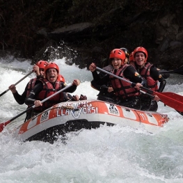
Rafting Llavorsí
LlavorsíRafting, canyoning, horse riding, hydrospeed, river canoeing, bob-coaching, hiking, snowshoeing, skiing and…
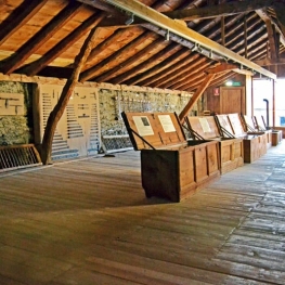
Espai museístic del Ferro Casa Sintet
Alins (Vall Ferrera) (a 5.9 Km)The museum offers a guided tour, led by the descendants of the…
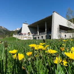
Turisme al Pallars Sobirà
(a 12.1 Km)Come and discover the highest peak and inhabited town in Catalonia, the…
Where to eat
Roch Hotel - Restaurant
Sort (a 10.3 Km)A small, family-run rural hotel, very welcoming, where its owners (Xavi and…
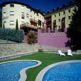
Where to sleep
Hotel Lo Paller
Alt Àneu (a 4.8 Km)Mountain Hotel, located in the town of Valencia d'Àneu, halfway between the…
Roch Hotel - Restaurant
Sort (a 10.3 Km)A small, family-run rural hotel, very welcoming, where its owners (Xavi and…