


Municipalities
From the plain of Vic, one of the profiles that is always outlined on the horizon are the crests of Pla d'Aiats and Cabrera. As if they were two "flans" or two towers with a very flat top, their shape is well visible from the plain. From above, the view is grateful and the surrounding forests in autumn are very attractive.
- Difficulty: low-moderate. Take into account the steep ascent towards Pla d'Aiats and a small rope pass near Coll del Bram. Be careful not to slip on the rock if the day is rainy or after the leaves have fallen.
- Unevenness: 656 m of accumulated positive unevenness.
- Time: between 4 and 5 hours depending on the pace and stops.
- Kilometers: 11.9 km.
- Variants: An alternative would be to go up to the Sanctuary of Cabrera from the hermitage of Sant Julià de Cabrera, through the GR-151 or take a circular route through the Sierra de Cabrera and Pla del Prat. A path could also be traced along the northern slope, coming from the corner of Falgars d'en Bas. As an alternative, we could add the Agullola de la Tuta to the peaks of the itinerary described.
Access
From the C-25 or from Vic, we take the C-153 towards Roda de Ter to Cantonigròs. We arrive after half an hour, after several curves and 20 km. We left the car right at the entrance of the town.
Route
From the parking lot in front of the Puntí restaurant, we take the path that runs parallel to the road in a North/Northwest direction until we reach the C-153 road just before the Rotllada Bridge. This first section coincides with the Camino de Santiago in the section from Vic to Olot. We cross the bridge and take the forest track that goes to the Caselles and Aiats farmhouses. (indicator stick). We continue along this track planning for about 20 minutes. Progressively we are getting closer to the Aiats cliffs, which are right in front of us. Halfway along, we ignore a crossroads to the left and right that would take us to the Caselles house. Further on, when we enter the forest, we find a fork in the track. We continue along the one on the right and we will return down the one on the left. The track crosses the Riera or Torrent d'Aiats and we continue to the house of the same name.
Once at the Aiats farmhouse, we skirt it and cross the rear meadows until we find the path and the cairns that begin to go up through the forest. Initially, we climb up some gullies surrounded by boxwood and progressively we will alternate sections of rock and deciduous forest. The path is winding and maybe during the autumn when the leaves fall from the trees the path becomes a little blurred. We will be finding some small milestones and old blue markings. At some point we will help each other with our hands to overcome the rocky spurs, especially on a ledge that we find when we pass near the ridge. Higher up, the views open up towards the western side of the mountain and we climb the last stretch of ascent through the Grau de l'Escaleta, a weak point of the Aiats Riscal through which you can climb in the middle of the beech forest. We arrive at the ruined house of the Cabaña del Pla d'Aiats. We pass by the side and continue along the path until we find the path that glides over the Riscos de Aiats. Now we will continue along this path between meadows and stretches of beech forest until we reach a landing where the flag and a poem by Miquel Martí i Pol can be found. At this point, the panoramic view of Collsacabra is stupendous and the view extends from Puigsou or Rocacorba (above Girona) to Montserrat and Berguedà. If you want to extend the view towards the Garrotxa, we recommend finishing skirting the cliffs until just before losing the slope to the north.
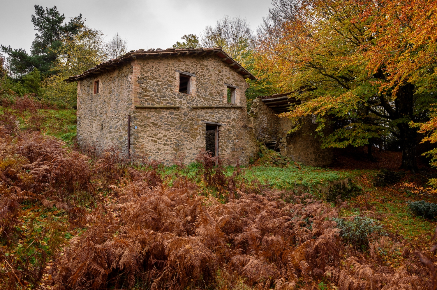
Once we have enjoyed the view, we go back to the junction with the uphill path and now we will continue flattening there between the meadows surrounded by ferns and the forest that alternates between beech and oak. The path heads north/northwest and just at the height of Puig Flabiol we begin to descend towards Coll d'Aiats. We will find blue marks along the way.
Right at this pass, we find a fork in the paths: we take the one on the right. The path borders the Puig dels Llops at the shady corner and we cross a small pass where there is a rope and some steps for greater comfort. It is not too difficult, but in case of wet ground or with a lot of fallen leaves, it will do well for us.
Shortly after, we arrive at Coll del Bram, where the forest track that comes from Sant Julià de Cabrera arrives. In front of us rises the cliff and the access stairs to the sanctuary. We can go directly up there, but we opted to skirt the cliff through the shade and go up the old detours that followed a cobbled path to access the hermitage. In this section there are some yellow marks and it is especially beautiful in autumn.
Once we reach the top, we will have the Sanctuary in front and the peak behind. We only need to follow the ridge (with great views on both sides) to the geodesic vertex. At this point, we will also find some old remains of the Castillo de Cabrera.
From this balcony, we enjoy the plain of Vic from a privileged point of view. We also see the Puigsacalm and other peaks of the Pre-Pyrenees. The location of the Virgen de Cabrera is exceptional and inside the sanctuary we can also have a restaurant on weekends.
To return to the Bram pass, we follow the stairs that go down the crest line and we quickly descend until we reach the pass again. At this point, we continue along the path that goes south and further on we find a fork in the paths: we continue along the one on the left (there is a small signpost). The one on the right would take us down towards Sant Julià de Cabrera. Shortly after, we jump off the slope towards Coma d'Aiats and continue along the path with blue markings (we avoid a path to the left with red markings). We are losing altitude making several detours until we reach the bottom of the valley through a beech forest with boxwood undergrowth (very affected by the boxwood caterpillar, as of 2019). When we are at the bottom of the valley, the path becomes a track and we gradually go gently down this old forest track until we find, once again, the deviation of tracks that we left in the morning. From this point, all we need to do is get to Cantonigròs along the same path we did on the way out.
Authorship photographs and text: Sergi Boixader

Nearby experiences
Nearby routes
Camino de Santiago: from Sant Esteve d'en Bas in Cervera
Artés, Cervera, Igualada, L'Estany, L’Esquirol, Manresa, Vic
At the end of the last century, the Catalan sections of the millenary and well-known route of the Camino de Santiago (99 km and +) began to be recovered. Today it is possible to travel, on foot, on horseback or by bicycle, the almost 500 km…
Route for adventure parks in Catalonia
Arenys de Munt, Barcelona, Cerdanyola del Vallès, Dosrius, Esterri d'Àneu, Llívia, L’Esquirol, Mataró, Molló, Porrera, Prullans, Salou, Sant Hilari Sacalm, Santa Susanna
Jumping from one tree to another, fly like a bird, feel the air and caress the cheeks, seeing everything from above, feel that indescribable feeling of living a unique experience and realize that all this have only the possibility of repeating…
Paths of the Bishop and Abbot Oliba
Artés, Casserres, Folgueroles, L'Estany, L’Esquirol, Manresa, Navarcles, Olesa de Montserrat, Sant Pere de Torelló, Santa Maria de Besora, Tavertet, Vic, Vilanova de Sau
The Barcelona regions of Osona and Bages, and the Girona region of Ripollès, are the protagonists of this route that takes the name of a capital figure in the history of Catalonia, the Bishop and Abbot Oliba. The route (173 km and +)…
Related routes
Route from Vilanova d'Escornalbou to the hermitages
Vilanova d'Escornalbou
Short-distance excursion that, from the town of Vilanova d'Escornalbou, will take us to the hermitages of the Virgen de la Roca and San Ramón de Mont-roig del Camp. These hermitages are erected on privileged watchtowers over the Baix…
Tour of the Carboner River in Setcases
Setcases
Itinerary that runs through high mountain forests where abundant fauna lives, from which we can detect traces. We will have fantastic views over the Ter and Carboner valleys. Route with a lot of contrast: first we follow the Carboner river;…
Roca del Corb and Sant Honorat in Peramola
Peramola
Around the Roca del Corb and Sant Honorat. This route will take us to know some curious rock formations, a whim of erosion. We will visit buildings under the caves, a memory of a not too distant agricultural past, and we will be able to enjoy…
Road to the Roset Castle in Vilada
Vilada
This tour brings us closer to the sunny sector of the municipality of Vilada, under the Sierra de Picamill (1,415 m), where we will find the ruins of the Castle of Roset and enjoy wonderful views of the Mergançol valley and shady mountains…
Events
Amateur Theatre Showcase in Sant Gregori
16 OctoberEuropean Heritage Days in Collbató
16 OctoberAlfaro Year in Sant Andreu de Llavaneres
16 OctoberRACC Costa Dorada Rally in Salou
From 16 to 17 OctoberZim Zam Cassà - Cassà de la Selva Urban Art Festival
From 16 to 17 OctoberModernist Conferences in la Garriga
From 16 to 18 OctoberTortosa artery
From 15 to 18 October








 Sustainable turism
 Biosphere