


Municipalities
El Catllaràs is one of the largest and most wooded mid-mountain extensions in Berguedà. Without exceeding 2000 meters like other neighboring mountains, the trees become masters of the mountain up to the most rounded peaks. Only in some clearings, flat and rocky cliffs, do we stand out from this immense green carpet tinted with some beech ochres. On this route we propose to get to know Catllaràs from its southern slope, from Sant Romà de la Clusa in a quick and easy approach.
- Difficulty: easy. No difficulty, very affordable.
- Unevenness: 471 meters of accumulated ascent.
- Time: between 2h15 and 2h45' in total. Partial: about 40 minutes to Rasos de Clarent, about 20 minutes to Coll Pan, half an hour more to Pla del Catllaràs and just over an hour when returning via Collada de Sant Miquel towards La Clusa.
- Kilometers: 9.7 km.
- Variants: Pla del Catllaràs can also be reached from the north slope from Pobla de Lillet by the PR-C 52 (17 km) or from Falgars and the Chalet del Catllaràs. From Rasos de Clarent, you can follow the track (old GR) to the Grau Pedrís pass to have good views of the Ardericó shaded area. We can also choose to crown Puig Lluent and Serrat Negre, although the peaks are covered with forest.
To reach
We follow the C-16 until we have passed Berga, we turn onto the C-26 towards Vilada and, almost at the end of the town, we take the track that goes to Sant Romà de la Clusa (10 km, in good condition). We can also get there by taking the Castell de l'Areny road and taking a detour towards La Clusa.
Route:
We leave San Romano de la Clusa heading east, passing by the Clusa refuge. We follow the marks of the GR-241, which crosses Catllaràs from east to west. We start on the track that leaves the refuge but we quickly turn right along a path marked by the GR signs.
We begin to climb slightly and we approach the Baga de Clarent, where we will find a magnificent beech forest on the shady slope of the mountain range. We gradually gain in altitude and arrive at the Rasos de Clarent, from where we will have a magnificent panoramic view of the entire Catllaràs that descends towards Sant Jaume de Frontanyà and Borredà.
From Rasos de Clarent (you will also find it as " Els Altars "), we follow the cattle fence and continue up the GR uphill towards Coll Pan. Here it is necessary to clarify that in editions of the Alpina or ICC maps, the GR marks towards a track that goes gliding up to the Collada Fonda or Puig Lluent, but on the ground we have seen that the GR goes up to the Neck Pan for a path in the middle of the forest.
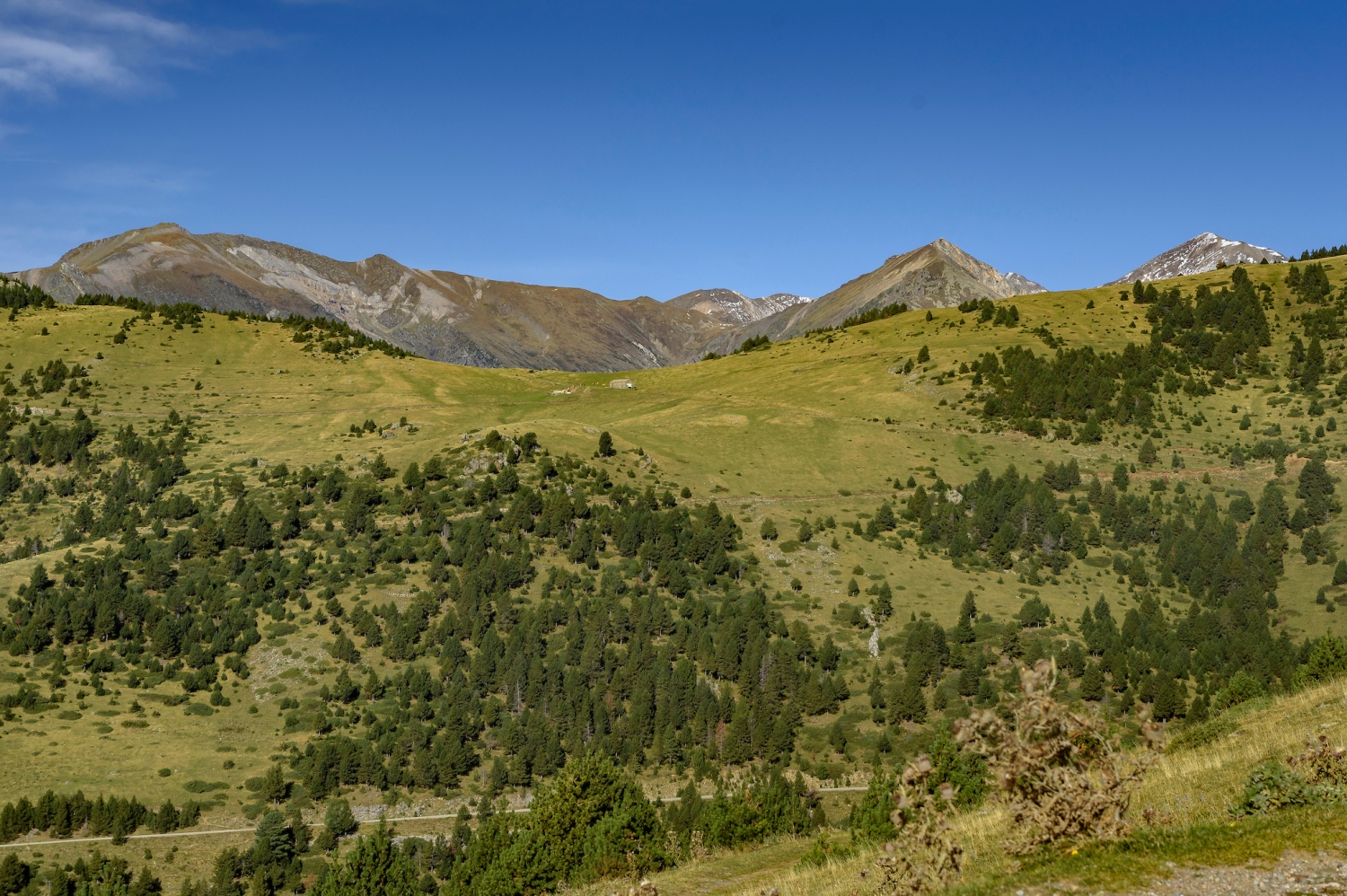
About twenty minutes later, we arrive at this pass and from here, we can choose whether to go to the right to have good views from the meadows near the Coll de Grau Pedrís and climb the Pedró crest and Cape Baga Alta. Or, do as we do: break to the left (we leave the GR) and walk along the track that goes down to the Plans del Orri, where we will see excellent views of the Sobrepuny.
Photographs and text authorship: Sergi Boixader

Nearby experiences
Nearby routes
We make trekking in Vilada
Vilada
Vilada is a small municipality in the Berguedà region with just over 400 inhabitants in an incomparable natural environment. We propose a series of itineraries so you can get to know more about all the architectural and natural heritage…
Looking for mushrooms in Berguedà and Solsonès
Avià, Bagà, Berga, Capolat, Casserres, Castellar de n'Hug, Cercs, Gironella, Guardiola de Berguedà, L'Espunyola, La Pobla de Lillet, Olvan, Prats de Lluçanès, Puig-reig, Saldes, Sant Llorenç de Morunys, Solsona, Vilada
Mushroom hunting has become a national sport in its own way and we have to enjoy our forests. Go to look for mushrooms and is a general obsession, and this is great news because it means that citizens of this country appreciates and loves the…
Route Canals of San Miguel in Vilada
Vilada
We propose a route through the town of Vilada, which will allow you to know and pass from abrupt shadows to the calm of the plans of this village of Berguedà. It is a beautiful but demanding route that can be started both from the village…
Road to the Roset Castle in Vilada
Vilada
This tour brings us closer to the sunny sector of the municipality of Vilada, under the Sierra de Picamill (1,415 m), where we will find the ruins of the Castle of Roset and enjoy wonderful views of the Mergançol valley and shady mountains…
Related routes
A trip to prehistory through Ardenya-Cadiretes, in Tossa de Mar
Tossa de Mar
Along the heights that surround the peaks of Montagut and Cadiretes leaving the sanctuary of Sant Grau, we will find excellently preserved megalithic prehistoric monuments along the entire route until we come across the jewel in the crown of…
Guissona dry stone route
Guissona
This self-guided tour follows part of the route of the Guissona Greenway and will allow you to get to know the environment in all its historical and heritage richness. Walking along the various routes, you will be able to enjoy the dry stone…
Walk of the Doctor in Vilada
Vilada
Vilada offers us this family walk, next to the town, where long ago Dr. Soler's patients recovered from their chest diseases in contact with nature. Today converted into a public space of the town, the Viladans come for a walk and to enjoy…
Route of the Castles of Sió
Cervera, Els Plans de Sió, Montornès de Segarra, Ossó de Sió, Tordera
The Route of the Castles of the Sió runs basically by a flat zone furrowed by the river Sió. It is an MTB itinerary of low difficulty, with a route of almost 42 km. The point of departure and arrival is Cervera. Along the way…
Events
European Heritage Days in Collbató
16 OctoberAlfaro Year in Sant Andreu de Llavaneres
16 OctoberForest week in Sant Celoni
16 OctoberRACC Costa Dorada Rally in Salou
From 16 to 17 OctoberZim Zam Cassà - Cassà de la Selva Urban Art Festival
From 16 to 17 OctoberFirauto Balaguer
From 16 to 18 OctoberFira Mediterrània de Manresa 2026
From 15 to 18 October
News








 Sustainable turism
 Biosphere